The Victoria Circle Paddle Route, an obvious but often overlooked route
The Victoria Circle Loop is a kayaking route full of changing landscapes that can take up an entire day if planned carefully. There is now interest in improving some access points to this route including developing a walkway under the Tillicum Bridge allowing an easy portage if the tides aren’t favourable. For more information, see Victoria Waterways Route.
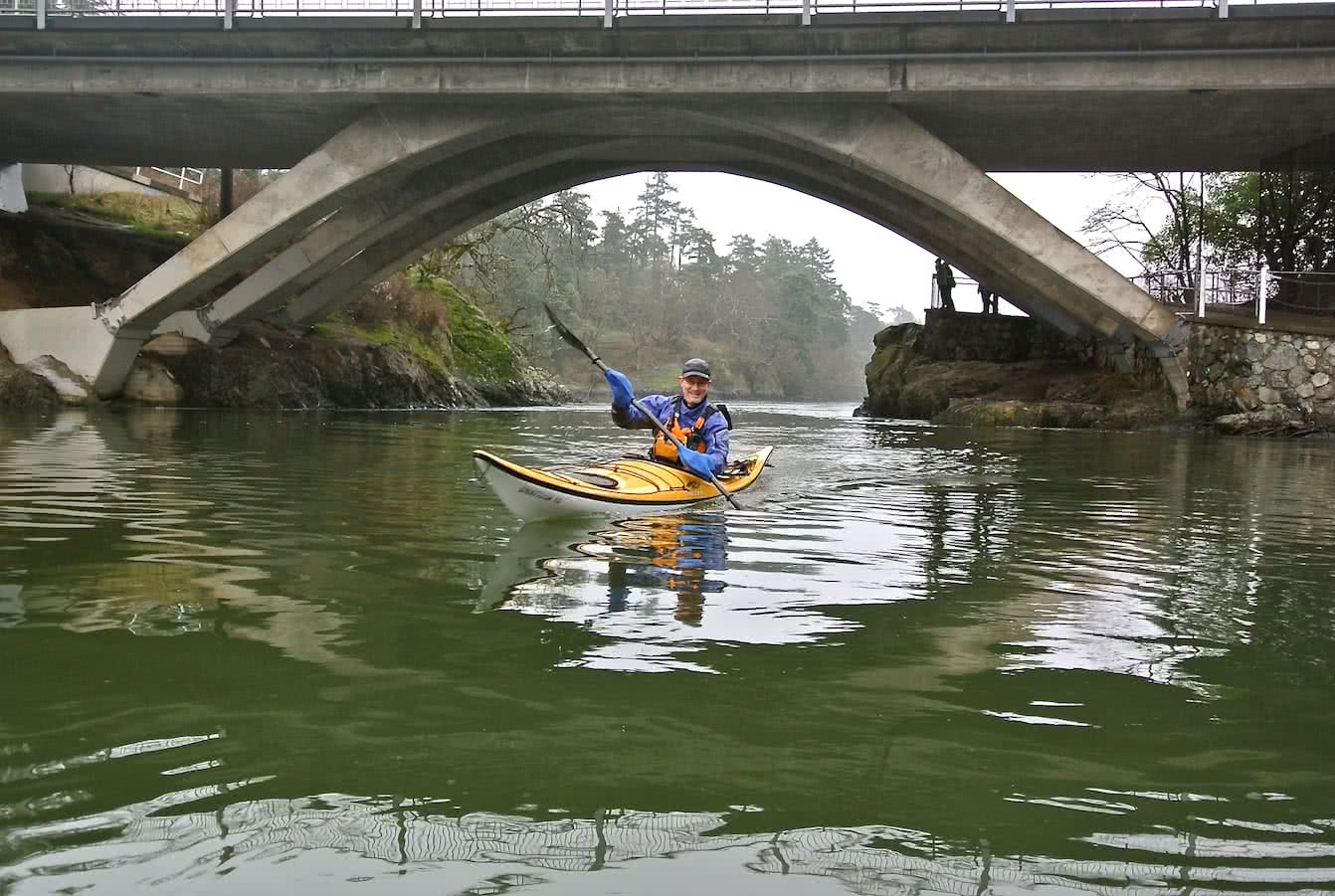
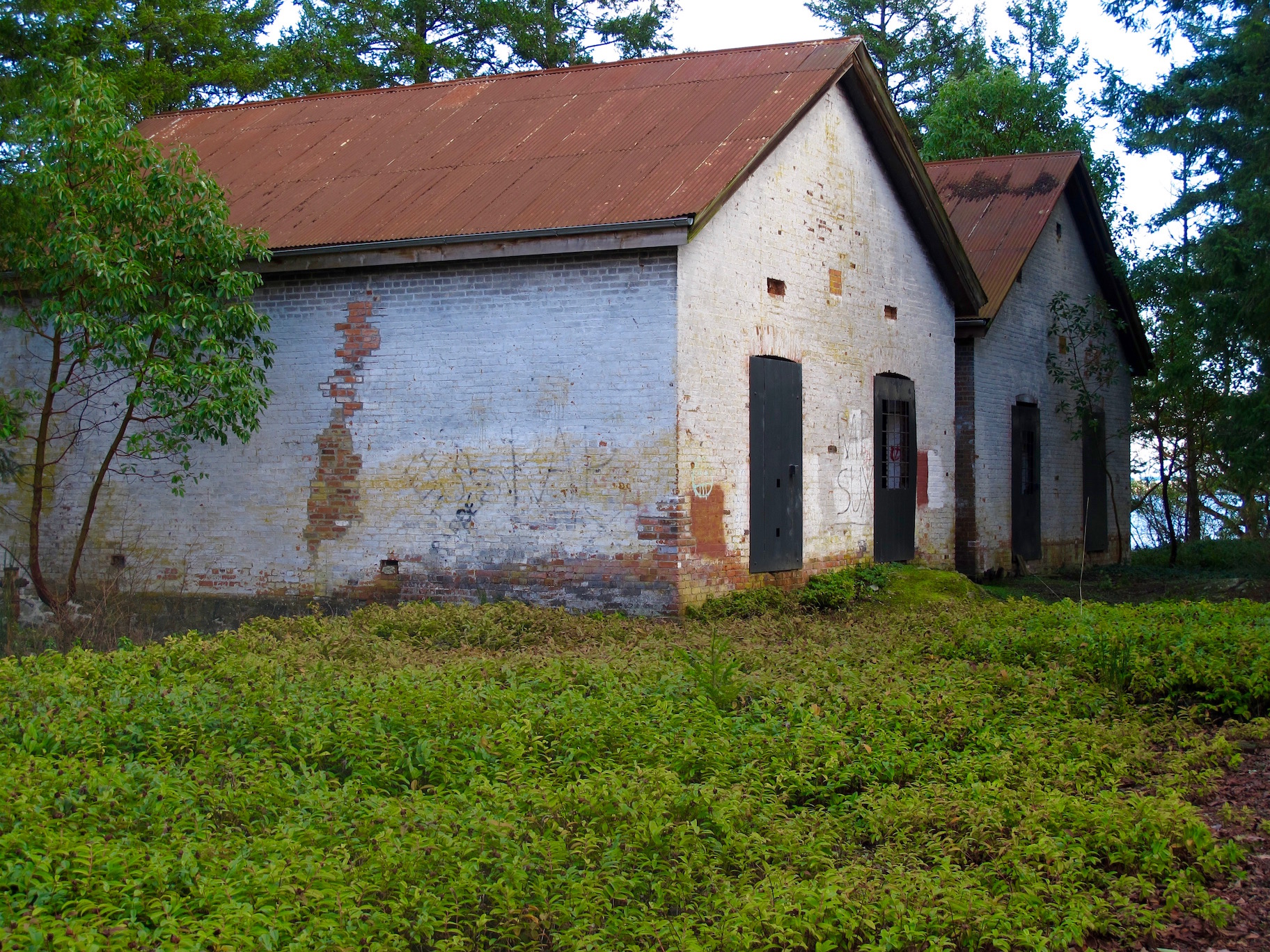
Gorge Tillicum Bridge
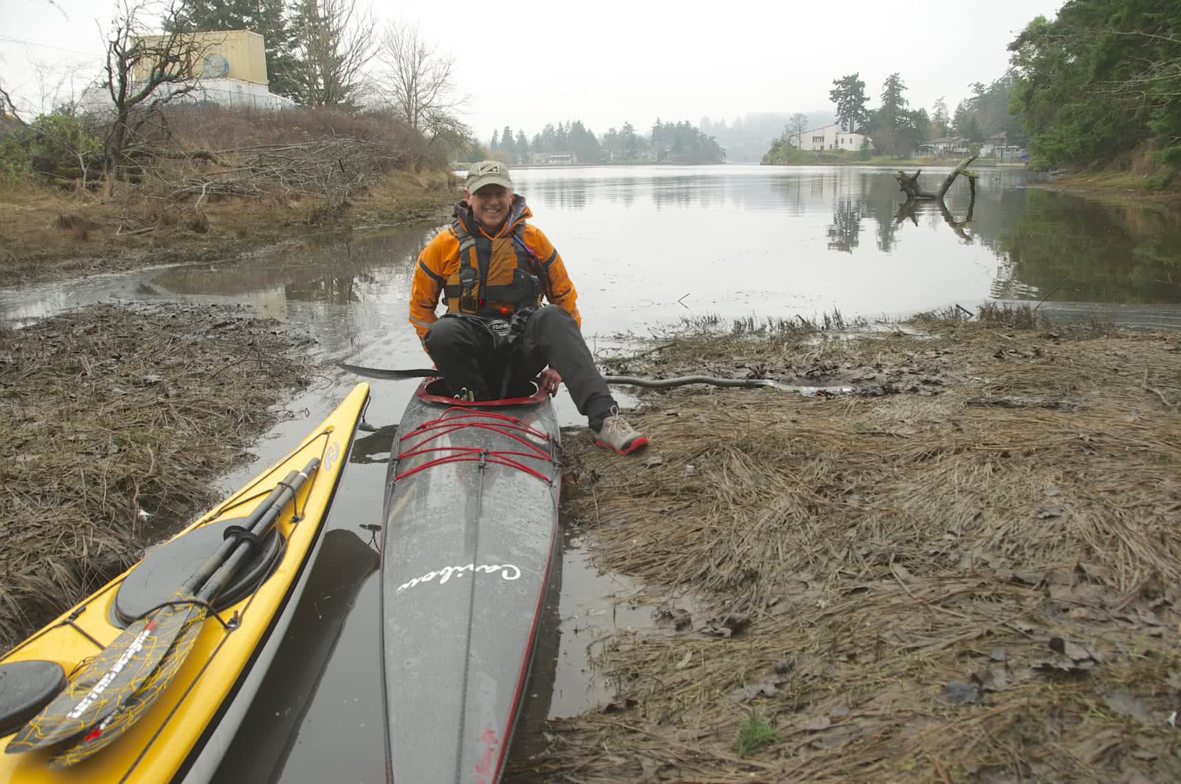
The Victoria Circle Kayak Route can be paddled in either direction and can take about 3 to 4 hours. On the day we went, my friend Bruce Holland and I chose to go counter-clockwise but in some weather or current conditions, it may be better to reverse directions. We kayaked from the Ocean River Sports Docks in Victoria’s Inner Harbour, up the Gorge Waterway, to the end of Portage Inlet in View Royal Municipality. At that point, we went over-land through Portage Park, portaging our boats to a beach on Thetis Cove in Esquimalt Harbour. Once back in our kayaks, we headed out of Esquimalt Harbour past The Naden Canadian Forces Base. Paddling past Naden, we turned south-east and travelled along the Esquimalt shoreline back to Victoria Harbour. For more details about paddling in Esquimalt Harbour check out Esquimalt Lagoon to Cole Island.
Details of this trip Broken Down
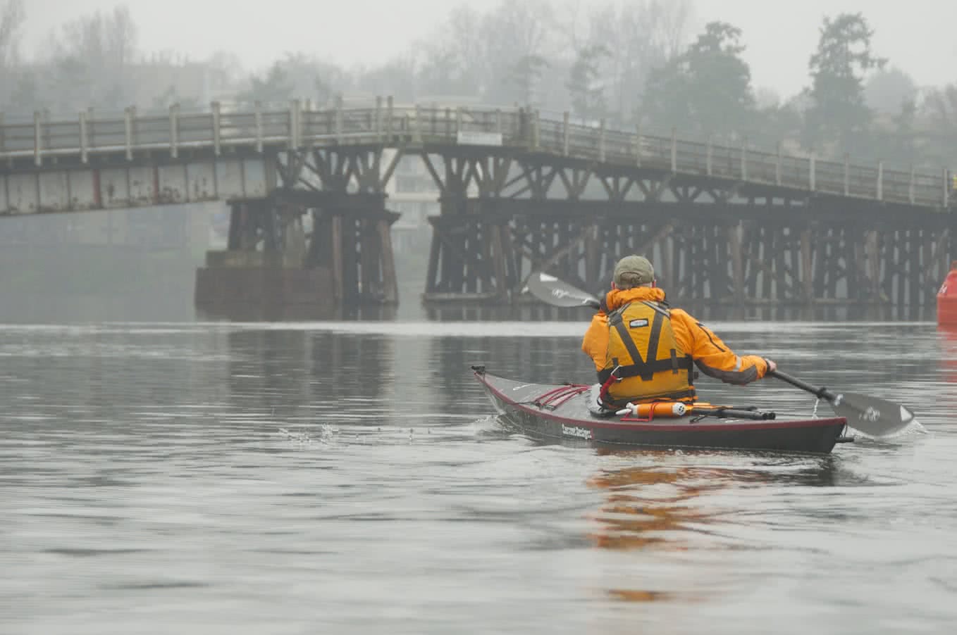
Selkirk Trestle
The first stretch of water, locally referred to as the Selkirk waterway passes through the industrial part of Victoria harbor. Once you pass under the Selkirk Bridge, entering the Gorge Waterway, you begin to see the beauty of this inland passage, with beautiful homes, parks, bridges and other interesting landmarks. After about 30 minutes of paddling, you will come upon a constriction where the waters narrow down to approx. 10 meters (30’) wide directly beneath the Gorge-Tillicum Bridge.
Gorge Tillicum Bridge
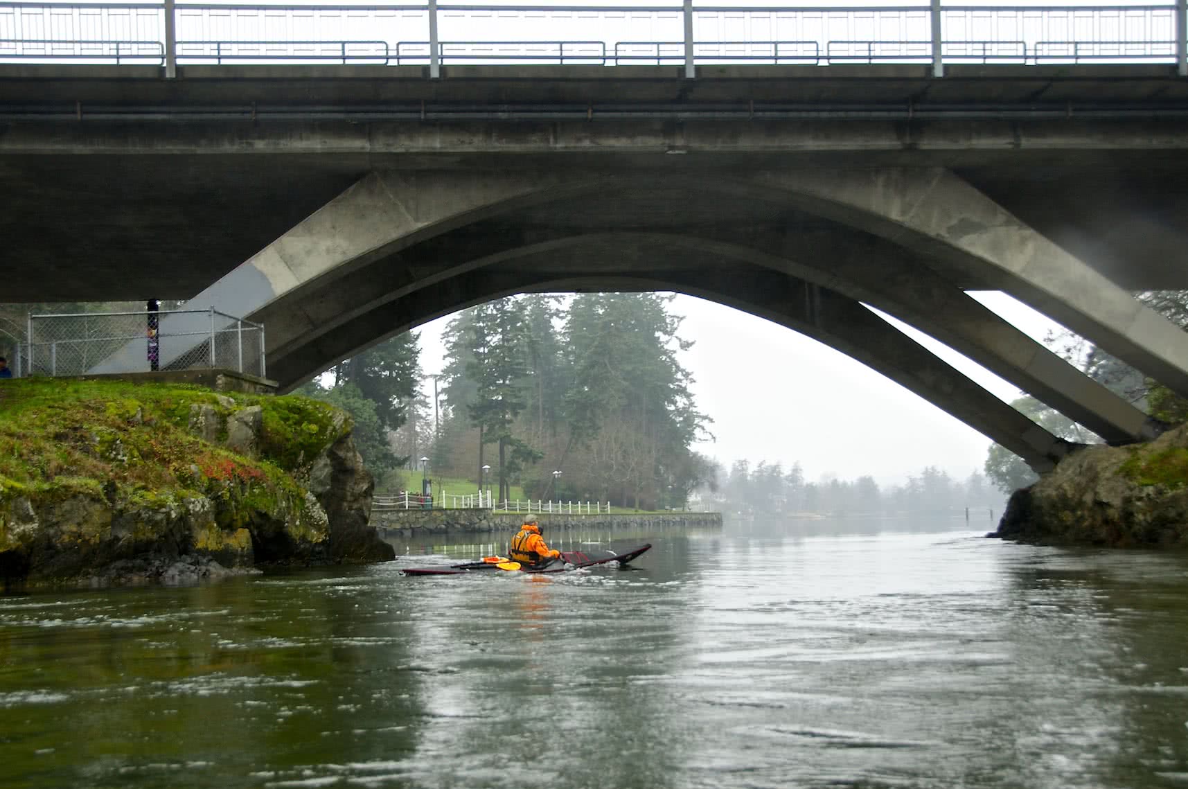
Tillicum Bridge & Narrows
Under the bridge is Tillicum Narrows and when the tides are right, it can become a raging tidal rapid. This natural wonder is a tidal overfall that can run as fast as 12 knots, or 22 kph, at times. You must take care and read the tide and current tables in order to plan your trip through the Narrows when it is slack tide or at least slow enough to allow you safe passage.
Warning: See the trip planning section in this blog post to understand how to get through the Tillicum rapids safely. Depending on the flow of the water, it can be either with you or against you. Without proper preparation and skill level it can be extremely dangerous to paddle through the Narrows and more than a few kayaks and canoes have been capsized and lives have even been lost.
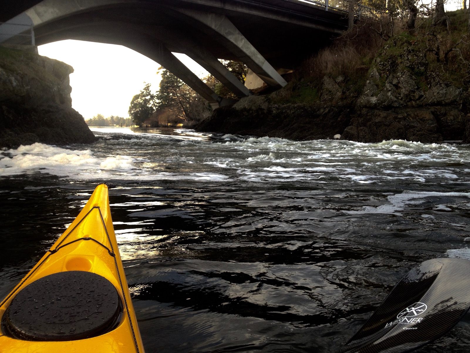
Rapids at Tillicum Narrows
We continued paddling up to the end of Portage Inlet and landed to the left of the municipal service building. This section of the trip took us approximately 1 hour and 20 minutes. When the tides are high, you can land here without any problems. However, at low tides, there are large mud flats here and the boot sucking mud is not negotiable. If this is the case, you may have to exit early via a public water access site located between 2772 and 2775 Shoreline Dr which is on the opposite side of the peninsula (see map). From the water it is located in a cove between two private docks, just a short distance past the Admirals St bridge. There is a boat ramp and path leading to Shoreline Dr. From here you can walk across Shoreline Dr into the school parking lot and onto the path which will take you up to old Island Hwy and the E&N Trail bridge across it.
It is recommended that you exit at the boat ramp and path to avoid the mudflats and to avoid any adverse environmental impact.
The Portage
High Tide Exit at the Portage – We no longer recommend landing here to protect environmental impact
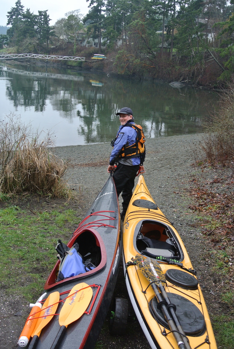
Once out of your boats at the end of Portage Inlet, this is the beginning of the portage. At this point, we go from paddling our boats to carrying them. Kayaks really aren’t the easiest thing to carry by yourself, so if you’re going solo, we highly recommend a kayak cart. These clever devices easily disassemble for storage in your kayak but once reassembled easily allow you to pull your kayak along.
If there are two of you, it is possible to do a simple double carry, depending on the weight of your kayaks. We followed the sidewalks under the railway/pedestrian bridge crossing the old Island Hwy and onto the pathways of Portage Park.
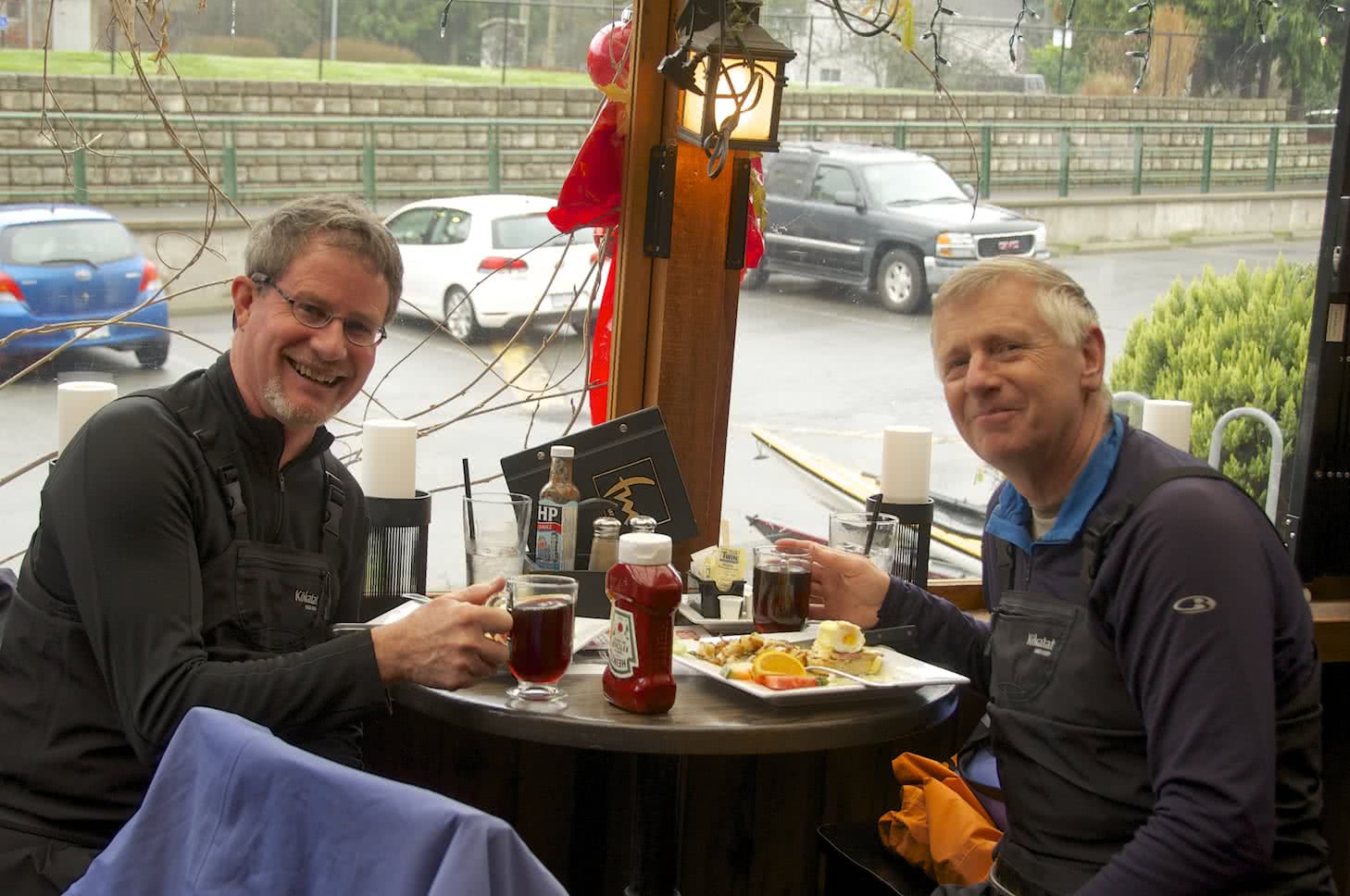
Time For Lunch?
Bruce & Brian at the 4- Mile
If you are feeling hungry at this point and your timing is good, an easy 100-meter detour up the hill will take you to the Four Mile Brew Pub & Grill for a lunch.
Portaging through Portage Park
The paths of Portage Park have all recently been upgraded. Some of them are paved and some are packed gravel so it is a short, easy and pleasant hike down to the beach on Thetis Cove, part of Esquimalt Harbour. As you paddle into Esquimalt Harbour, on the left you will pass Songhees First Nations land and then Naden, the Canadian Forces Naval Base. On your right, you will see the historic Fisgard Lighthouse and Fort Rod Hill.
Important Note: Esquimalt Harbour is now a controlled access area. All visitors must contact the King’s Harbour Master prior to entering, moving within or departing the harbour. Use VHF Channel 10 or 250-363-2160 on your phone.
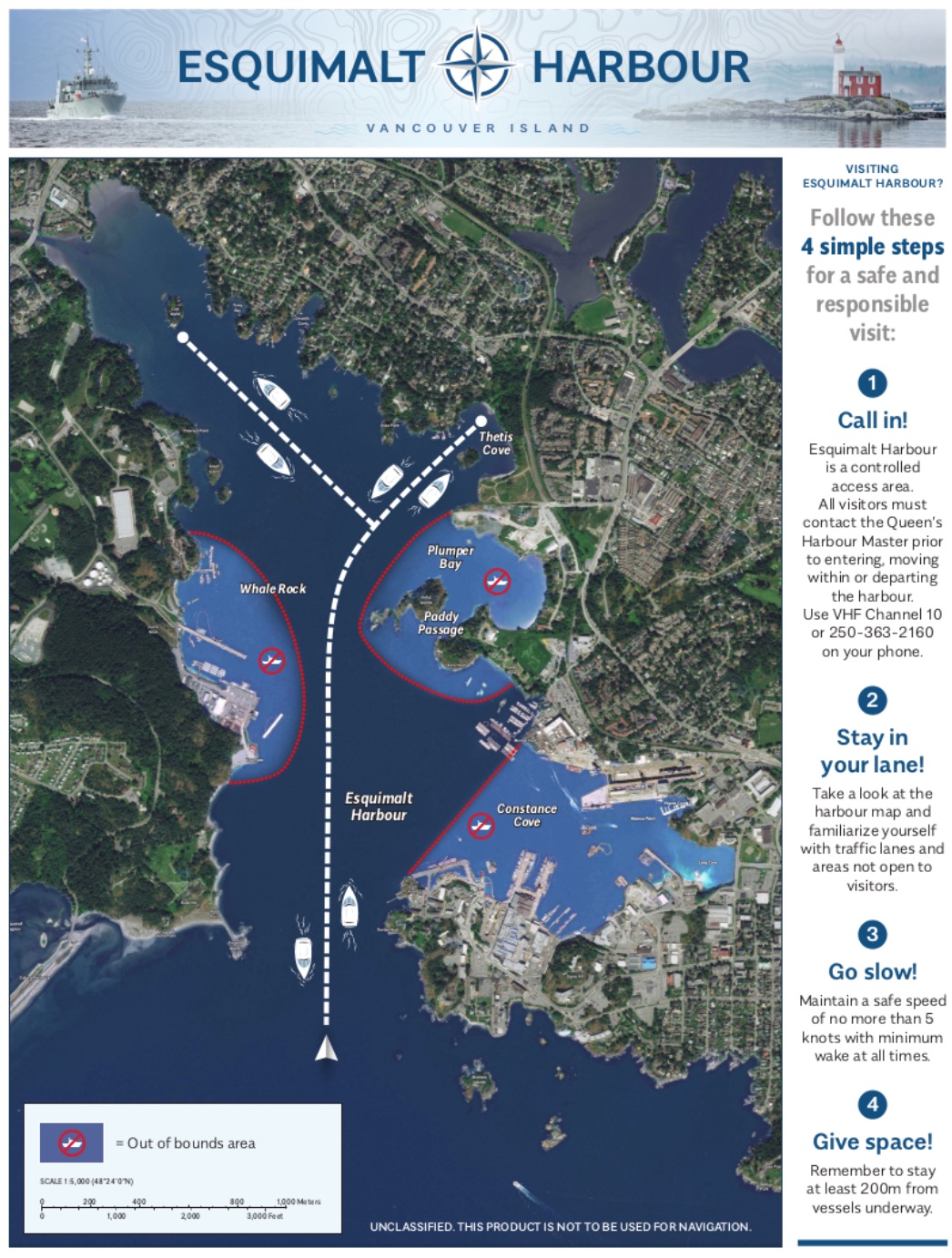
Esquimalt Harbour Movement Rules
If you care to extend your paddle a little more you can turn right out of Thetis Cove and check out the WWI era munitions storage and loading buildings on Cole Island, which is another National Historic Site. Cole Island is now cared for by the Friends of Cole Island Society under the auspices of the Provincial Heritage Branch. The FoCIS have installed a dock making access to the island much easier and visitors are welcome from sun-up until sun-down.
Once you are out of the harbour, it gets a bit more open as you head south-east along the shoreline. You will pass beautiful Saxe Point Park and McCauley Point Park along the way. The coastline along here has a much more rugged, west coast feeling.
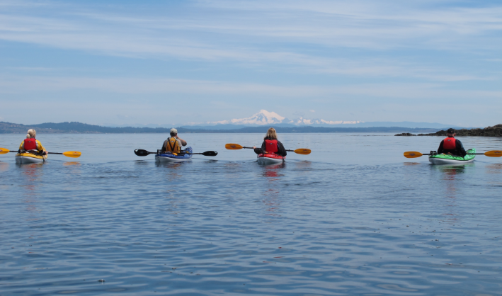
As you round the point coming out of Esquimalt Harbour, keep in mind that you are now in The Juan De Fuca Straits, so caution must be taken to check your forecasted winds. You should probably not go if the winds are forecast over 10-12 knots. This area can be a rough and inhospitable stretch of water.
Once you hit the open entrance to the Victoria Harbour, paddle in on the west side, staying out of the way of bigger boats and aircraft. Note that Victoria has a very active marine airport, so it is necessary for kayakers to say to the left side all the way back into the harbour, and back under the Johnson St Bridge. Once under the bridge, check for traffic and cross over any time it is safe and you will land back at Ocean River Sport’s docks on your right. For more details on paddling in Victoria Harbour check out our Victoria Harbour Post.
Cole Island – Munitions Storage Buildings
The paddling time, including the portage, is between 3 and 4 hours (not including lunch break). This is only an estimate and is dependent on how fast you paddle and it also depends on how big and social your group is, as well as how much photography or bird watching you do along the way.
Details of the paddle route
The total distance covered was approximately 16.8 kms or 9 nautical miles, combining roughly 16 kms of paddling with a 750 m (800 yds) portage and took us about 4.5 hours.
Wildlife sightings along the route
River Otters, mink, seals, various Gulls, Bald Eagles, Oyster Catchers, Harlequin Ducks, Red Breasted Mergansers, Common Mergansers, Hooded Mergansers, Buffle Heads,Cormorants, Great Blue Heron, Common Golden Eye, American Wigeons, Mallards, Mute Swans, Western Grebes, Horned Grebes, Cormorants, Murres, Pigeon Guillemots, and various shore birds are just some of the wildlife species you can expect to see.

Bald Eagle
Trip Planning:
Check the weather forecast: Particularly check the winds forecast for the day at the sites posted below. Our recommendation for most paddlers is to keep the winds under 10-12 knots or 18 – 24 kph. Check the times and vary the direction of trip depending on the winds direction and speed. If the winds are from the SE, consider doing the trip counter-clockwise, leaving Victoria Harbour and paddling with the winds to Esquimalt Harbour. Likewise, if winds are light in the morning but forecast higher in the afternoon, do the more exposed Juan De Fuca section in the morning.
Here are some recommended sites for good wind forecasts:
Environment Canada Marine Forecast
Check the currents at the Gorge-Tillicum Bridge – Here are two methods:
1. The easiest and perhaps the best way to do this is with a very convenient Phone app called Aye Tides. Just click ‘Find a Station’ and select Gorge-Tillicum Bridge. If currents are running more than 2 knots extreme caution needs to be exercised.
2. Using the Canadian Tide and Current Tables. Ebb refers to the water flowing out or going from high tide to low tide, this means the water will be flowing in an easterly direction at Tillicum. Flood refers to water flowing from low tide to high tide or westerly at Tillicum.
3. Tideschart also has a very easy to use webpage for checking currents at Gorge-Tillicum.
4. Alternatively, check in with the staff at Ocean River Sports Adventure Center
All in all a great day paddle. Keep in mind there are many other launching points along the Gorge, Portage Inlet, Esquimalt Lagoon, and Flemming beach that will get you in the loop!
Brian Henry & Bruce Holland
Yes, I was one of the unfortunate ones who paddled solo last Jan.26th through Tillicum narrows. It was a beautiful winter day, sunny and mild. It was the first time I paddled this area as I am paddling the coastline from Goldstream dock clockwise and counter clockwise around Saanich Peninsula and beyond.
I wasn’t aware of this phenomenon and cased it out before attempting to paddle west against the rapids. I thought if I could keep to the left as much as possible and give it all I got I’ll be OK. Well the current caught the front of my kayak and spun me back. I’d been in heavy seas before and navigated 2 meter high waves but this was a challenge. So I gave it another shot, almost making it through when whitewater hit the port brow and I capsized and was spun around caught in the eddy. I managed to make a wet escape gouging my shin on the cowl edge and spent a good 25 mins trying to swim my kayak to shore. I’ve never experienced this before and I’m in pretty good shape for a 63 yr. old but the cold water was sapping my strength plus the shock factor. Finally I climbed onto the dock there hauling my kayak from the swirling water. I lost my paddles and sunglasses but I keep a spare set on board just in case. I paddled back to my launch site just west of you guys and drove back to the scene of the crime only to find my paddles washed onto a ledge there under the bridge.
I love the water and kayaking but not under those circumstances.