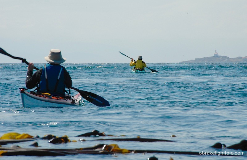
Paddling to Discovery Island is on the top of a lot of paddlers lists. It is a beautiful escape from the city that provides a wild and rugged west coast experience that can be explored in just a day. However, before setting out for Discovery, some careful trip planning is in order. If you are an experienced paddler this can be a wonderful and fun outing. If you are new to paddling or are unsure of the route, the weather and currents that may be encountered could present some challenging problems, so this trip shouldn’t be considered without an experienced paddler or guide present.

Sea Lions off Discovery Island
Planning Your Trip
Check the Weather Forecast
Most importantly, check the winds (speed & direction) forecast for the day at the sites posted below. Our recommendation for most paddlers is to keep the winds under 10-12 knots or 18 – 24 kph. You will most likely run into tide rips in the channels on this trip, which in themselves can present challenges to the inexperienced paddle, but wind against the current will create larger, steeper waves in these zones. This means it is imperative that you are aware of the current and wind changes that may occur. What was a nice calm crossing with light winds in the morning may change to steep breaking waves with a change of current direction in the afternoon.
Here are some recommended sites for good wind forecasts:
Check the Currents
It is very likely you will experience a change in the direction of currents during a trip to Discovery Island. So it is important to understand what they are doing, including the direction they are flowing and how strong.
The differences between tides and currents.
Currents are generated by changing tidal action however, tides only refer to the depth of the water at high and low water at a particular location. A current station, on the other hand, measures the speed and direction of the water moving past a location. Importantly, you need to understand that times of high and low tide do not correspond to changes in current direction, so you cannot use tide tables to predict currents. This is particularly relevant around southern Vancouver Island.
Tide Rips in Plumper Channel
Warning: If currents are running more than 2 knots in the main channels, caution should be exercised. Tide rips will occur here and there is a likely possibility of wind against current in these zones creating larger, steeper waves. Strong eddylines (the transition between the main current and slower water near the shoreline) can easily capsize unwary paddlers.
How to Check the Currents
Aye Tides Phone App
1. An easy way to check the currents is with the phone app called Aye Tides. Just click ‘Find a Station’ and select Race Passage. This is the closest ‘main current station’ to Chatham & Discovery Islands. The currents in Baynes Channel, (between 10 Mile Pt and Chatham Island), run approximately half the speed of Race Rocks and do so 15 minutes earlier, regardless of the direction of flow. The currents in Mayor Channel and Plumper Passage run approximately half that of Baynes Channel, so you can approximate what the currents are doing from this data.
Canadian Tide and Current Tables
2. The Canadian Tide and Current Tables are available online by clicking the link. Go to page 68 of the CT&CT and you will find a listing for Race Passage. This is the closest ‘main current station’ to Chatham & Discovery Islands. The times of the turn to Ebb and Turn to Flood (essentially slack water), as well as the time of the maximum current flow are listed. The minus sign refers to the Ebb or water flowing out (a westward direction at Race) and the positive sign is the Flood or inflow (eastward). Once you have this information, you can now use the ‘secondary current stations’ listed on page 135 to find a listing for Baynes Channel. This table will tell you that Baynes Channel runs at about 75% of Race Passage and 15 minutes earlier, regardless of the direction of flow. For example, if the currents are 4 knots at Race, expect 3 knots in Baynes. Another tidbit of information you can glean from the nautical charts of the area is that the maximum currents found in Baynes Channel are 6 knots, and 3 knots for Mayor Channel. Therefore in our example, the current in Mayor Channel will be running around 1 1/2 knots, or half that of Baynes. Plumper Passage runs around 5 knots max so it will be just slightly less than Baynes.
4. Feel free to check in with the staff at the Adventure Center either by emailing us at, The Adventure Centre or phone at 250-381-4233 and we will be more than happy to help you out with your trip planning and supply you with any of the gear you may need for your adventure including boat and equipment rentals. If you would like to upgrade your paddling and/or navigational skills so you can safely participate in trips like this and learn more about paddling in currents and rough water, check out our awesome kayak course curriculum.
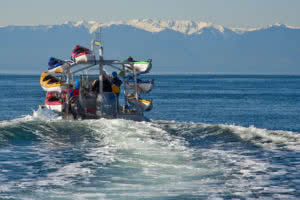
The Ocean River Sport’s ‘Discovery Shuttle’ offers guided trips to Discovery Island
Other weather considerations
Fog: Fog can form at any time of year around Chatham & Discovery, but it is more prevalent through the months of August and September. Sea fog forms as a result of warmer air meeting the colder waters of the ocean. Fog can roll in quickly and completely obscure visibility. You should be prepared with a compass and chart and/or a GPS so you can safely navigate your way back. If you are using a compass, keep in mind you will have to compensate for drift caused by the current. Also be aware that unlike radiation fog, which forms over land in calm air conditions, sea fog can be associated with high winds.
Water Temperature: The waters here are cold all year round with average winter temperatures running 7.0-8.0ºC (44.5 – 46.5ºF) and only warming to 10-11.5ºC (50 – 53ºF) from May through October. In waters this cold exhaustion can occur in 30-60 minutes or less and survival times are between 1-3 hours. Dress appropriately and always wear your PFD!
Skills and Equipment You Should Have
1) The necessary skills to paddle rough water conditions that can be experienced here, including assisted and self-rescues.
2) The skills to do the necessary trip planning to avoid potentially hazardous conditions. Keep in mind that conditions here can change rapidly, so once on the water, always be aware.
3) Wear the appropriate clothing. Dress for the water temperature.
4) Have the necessary rescue equipment with you including signal flares and some form of communication device such as a cell phone in a waterproof case (make sure you can operate it in the case and the battery is charged), a VHF radio, Personal Locator Beacon (PLB) or satellite messenger such as the Spot or inReach. They could save your life! Check out our post on Emergency Communication Devices.
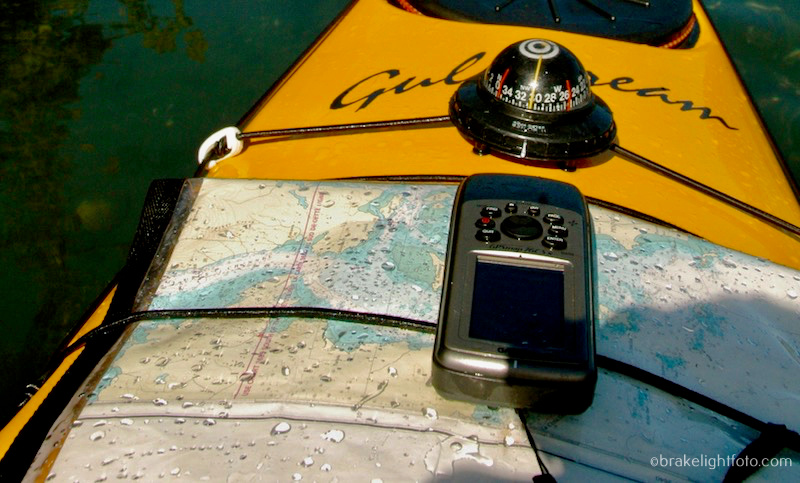
Make sure to carry charts, compass and/or GPS with you
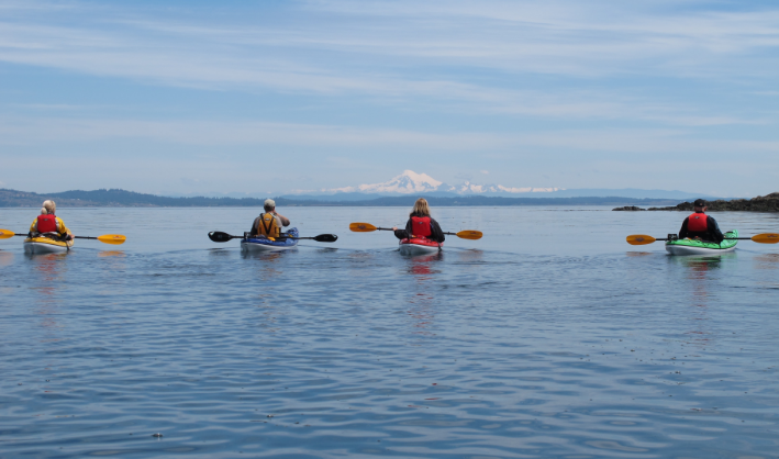
Plan a Route
Once you have considered your skills, checked the weather and the currents, you will need to plan which route you will take to get to Discovery Island. It is always better to plan routes where you can cross currents rather then fight against them. We have included a link below to another post which will take you through one of our favourite and safest routes, departing from Oak Bay Marina. Optionally you can leave from Ten Mile Point, which is a shorter crossing, but potentially has much stronger currents to deal with.
As a final note, make sure that you leave a float plan with someone before you go, in case the unexpected happens.
Check out our post, Paddling Route to Discovery Island, for what to see when exploring Discovery Island.
Happy Paddling!
Bruce Holland – You can also catch me at Ourhomehas6wheels.com or Brakelightfoto.com
thx for your blog entries. your link to tides/current is erroneous, it goes to the juan de fuca east entrance marine forecast from ECCC (for whom I work). also, I am pretty certain many novices will be confused by your choice of language relating current direction! If i can be so bold: westerly (from the west for wind) and westward (to the west for currents).
In the weather world we speak about westerlies for wind, as coming from the west. Currents get the moniker of westward, flowing to the west (which makes sense as the boat cares more where the current is taking them. If true novices are relying on this blog info, they could be very much confused by what they find in the Discovery Island context and furthermore, potentially putting themselves in danger as a result of this confusion… respectfully, Armel
Hi Armel, Thanks so much for your comments. It is always great to hear from very knowledgeable people like yourself and we and we really appreciate you pointing out the erroneous information in our blogs! I have gone back in to the post and made the corrections you have suggested, fixing the incorrect link and changing the descriptions for current directions…that does make more sense. Thanks again! Bruce