Paddling Victoria’s Upper Harbour, the Selkirk Waterway & the Gorge Waterway
Paddling the Upper Harbour and along the Gorge Waterway gives you a completely different perspective than the Inner, Middle and Outer Harbour. You will pass by the industrial area of the harbour as you move into the Selkirk Waterway and finally the Gorge Waterway itself. Here you will begin to see the real beauty of this inland passage, with beautiful homes, parks, bridges and other interesting landmarks.
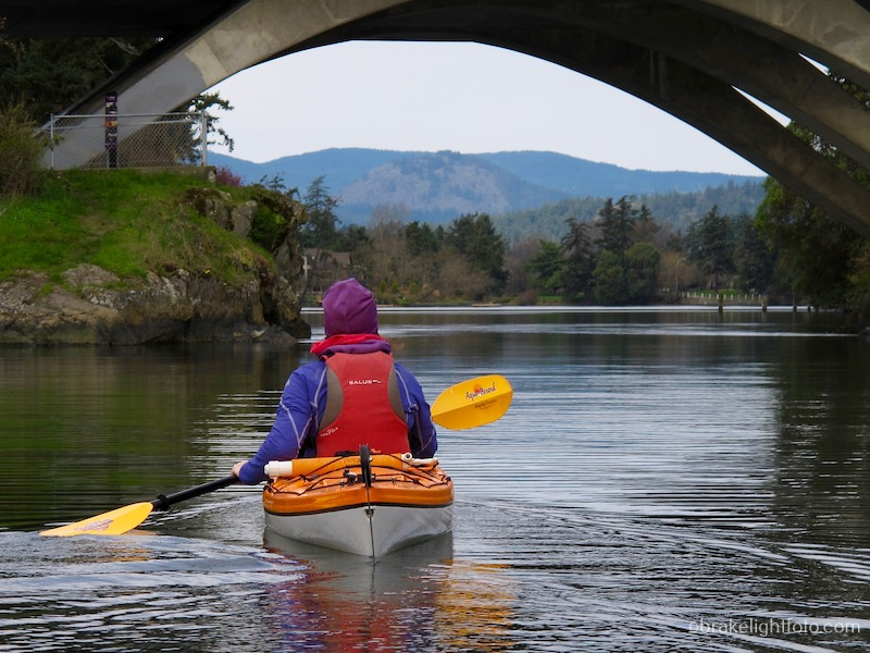
Kayaking the Gorge Waterway near the Tillicum Bridge
This route is approximately 5.5 km (3 mi), and you should allow 1 1/2 – 2 hours depending on how fast you paddle and how much time you take for pictures and socializing.
A word of warning: The area north of the Selkirk trestle may, at times, be congested due to Harbor Ferry’s and rower and canoe training activities. This area is beyond the Victoria Harbor boundary and is not patrolled by Harbour Patrol.
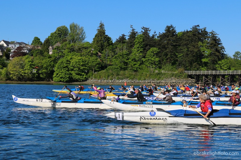
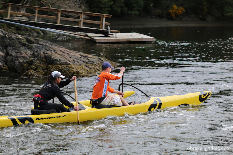
Outrigger Canoe Race in the Selkirk Waterway
As you leave the Ocean River Sports Docks, turn right and paddle along the right shore toward the Bay St. Bridge. You will see Point Hope Ship Yards across from you on the left, Ellice Recycling on the your right followed by, Lafarge Cement and the Ralmax gravel and recycling yard as you approach the bridge. Definitely very industrial and not the most scenic part of the harbour, but this will soon change.
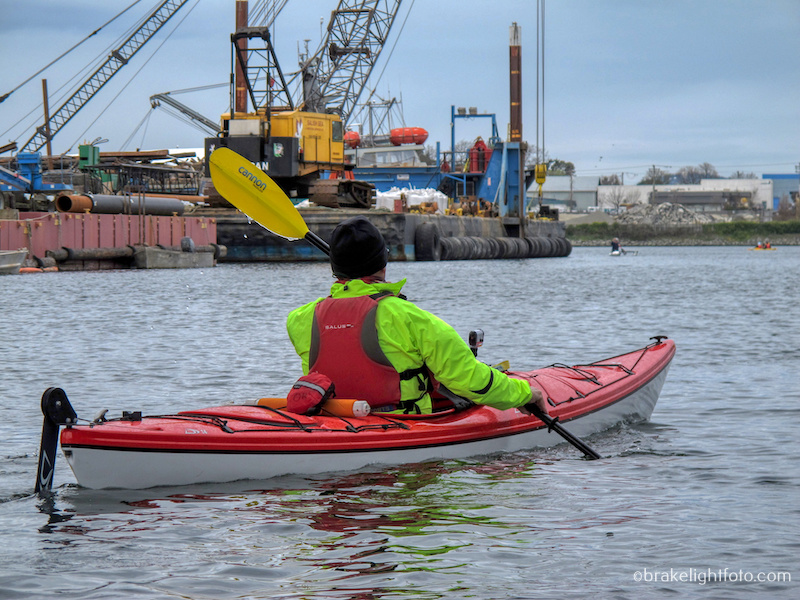
Kayaking Victoria’s Industrial Upper Harbour
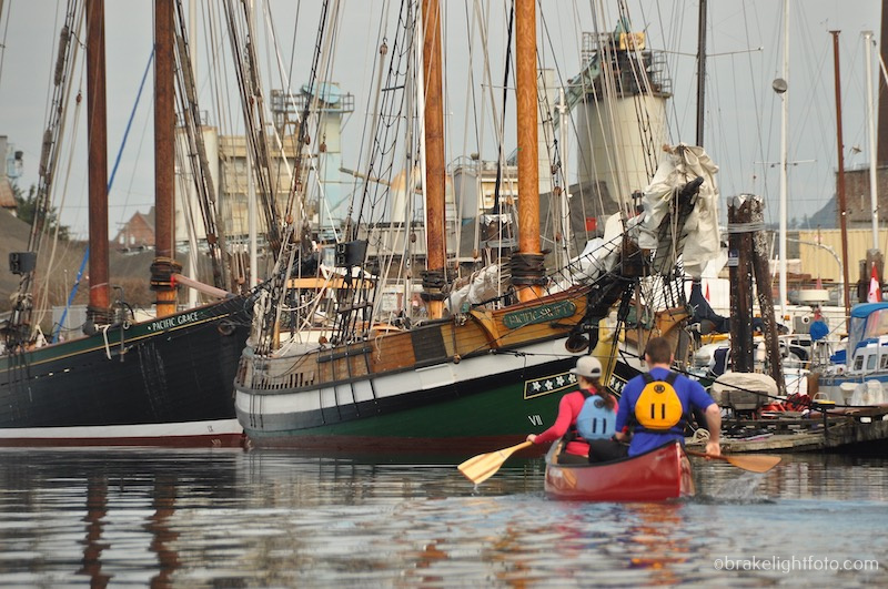
Canoists Passing the SALT sail training vessels near the ORS Docks
The Bay St or Point Ellice Bridge you will pass under was completed in 1956, although those beautiful granite piers it is set on, date back to 1902. This is also the site of the Point Ellice Bridge Disaster which occurred on May 26, 1896, when a streetcar carrying 143 passengers on their way to attend Queen Victoria’s birthday celebrations, crashed through the bridge into the water. 55 men, women and children were killed in the accident, with only those passengers on the left side of the streetcar being able to escape. This is one of the worst disasters involving the loss of life in British Columbia’s history and also remains as the worst accident in Canadian transit history.
The Cove at Point Ellice House
On your right, as you paddle under the bridge, you will see a dock and a pathway leading up to the grounds of Point Ellice House. Point Ellice House was owned by the O’Reilly family who moved into the home in December of 1867. This house and property remained in the families possession for 108 years and was a gathering spot for Victoria’s social elite. The house and all it’s contents were sold to the Province of British Columbia in 1975. This is what makes Point Ellice house very unique. Most furnishings in historic buildings have been gathered from various sources or created for display. The O’Reilly family left behind everything from their furniture, kitchen utensils and dishes, board games, window coverings and wallpaper to clothing and more, making Point Ellice house a truly unique National Heritage Site. Stop for lunch or Victorian-Style afternoon Tea and a tour of the home. There is a beach in the cove behind the dock where you can land and there is a staircase leading up to the property. For more information click this link: Point Ellice House.
The Selkirk Waterway & Trestle and Halkett Island (at the end of the trestle)
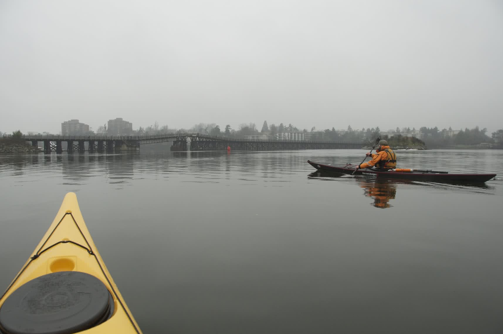
Once past Point Ellice, you will find yourself in the Selkirk waterway and the 91 meter (300’) long wood structure dominating your view is the Selkirk Trestle, originally built by the Canadian National Railway in 1916. It now a pedestrian and bike path, part of the Galloping Goose Trail, which starts from downtown Victoria, near the Johnson St Bridge, running 60 kms (37 miles) to Leechtown, the site of a gold-rush town no longer in existence. The trail was named after a gas-powered passenger rail car that ran on the line from 1922 to 1931.
Just before the trestle and off to your right is “Halkett Island” also known as “Deadman’s Island” as it was a burial site for the the Songhees and Esquimalt First Nations people. Sometime in 1867, a few school boys who were swimming here, lit a fire to warm themselves. There were piles of coffins and trunks on the island which were set on fire. The subsequent inferno burnt everything on the island including trees, scrub and coffins to the ground. In his 1912 book “Some Reminiscences of Old Victoria”, Edgar Fawcett admitted to how he was involved in this incident.
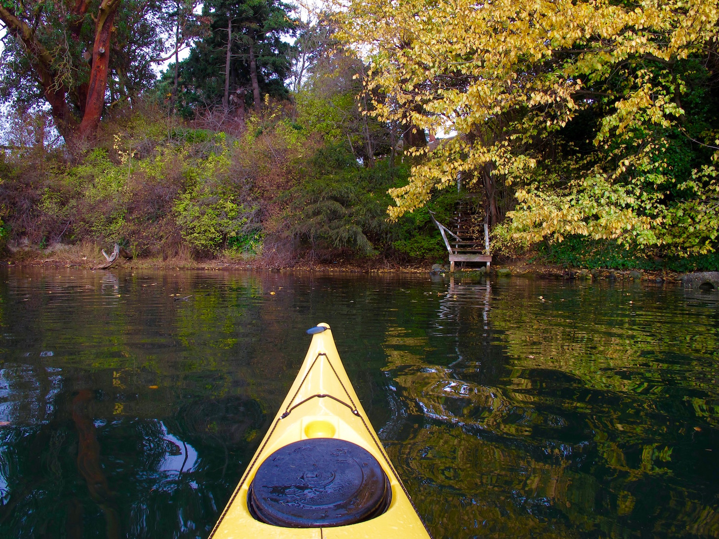
As you continue up into the Gorge waterway from under the Selkirk Trestle, you will begin to observe a very green and forested waterway, even though it is lined with private homes and apartment blocks. On your left after you pass under the trestle you will see a park on the hillside with a dock. This beautiful waterside park offers great views, a playground, tennis court, basketball court, and washroom facilities. It is also the sight of the annual Gorge Swim Fest, and surprisingly, in spite of the fact that the ocean waters around Victoria are very cold year round, the Gorge becomes quite warm in the summer. The Swim Feast happens in August and is a revival of the swim fest that occurred here over 100 years ago. Today the festival promotes & enable swimming in the Gorge Waterway by supporting initiatives that sustain the health, awareness & vitality of the Gorge. and can now happen again because of cleanup efforts.

Sections of the Gorge Waterway have a more wilderness feel
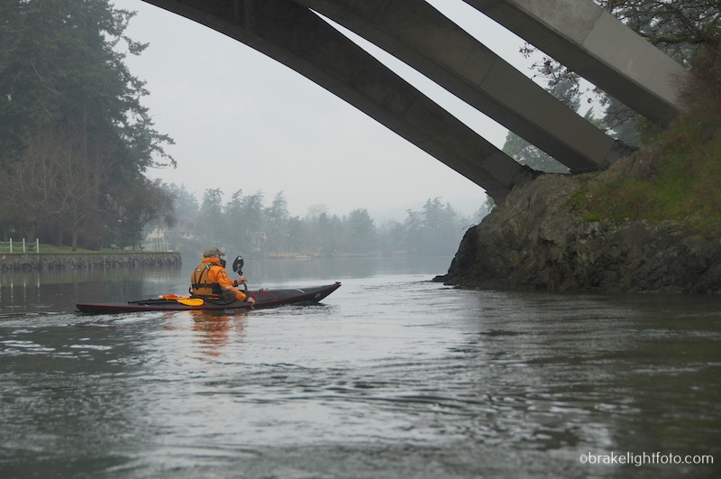
The final destination of this route is the Gorge Tillicum Bridge. There is a public dock on the right (north side) where you can get out and stretch our legs. The docks on the left (south side) are privately owned so don’t try and land there. Under the bridge is Tillicum Narrows and, because of rising and falling tides, it can become a raging whitewater rapid. This natural wonder is a tidal overfall that can run as fast as 22 kph (12 mph) on the outflow. Be extremely cautious even approaching this area as the eddylines, (the transition between the main current and the slower waters near shore moving in the opposite direction), can easily capsize unwary and/or inexperienced paddlers. If you plan to paddle up through here you must take care and read the tide and current tables in order to plan your trip when the tide is slack or at least slow enough to allow you safe passage both ways. If you have any questions on this area please don’t hesitate to consult the Adventure Centre staff.
C2 Paddlers shooting the Tillicum Rapids – The Public Dock is in the background
A light ebb at Tillicum Narrows
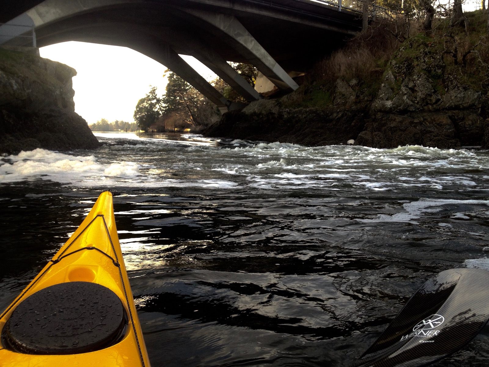
A strong ebb at Tillicum Narrows
Warning: See our blog post on the Victoria Circle Route for detailed instructions on how to paddle through the narrows safely. Depending on the currents, it can be flowing either with you or against you as. At any extreme current, it can be extremely dangerous. More than a few kayaks and canoes have been capsized here and lives have been lost.
From here you can turn around and follow the same route back to the Ocean River Sports Docks.
Safe Paddling!