Paddling Route and Exploration of Discovery Island
This spectacular paddling route takes you from the shores and stately homes of Oak Bay, crossing through the Chain Islets, to the Chatham Islands and Discovery Islands. This popular destination offers a true west coast paddling experience. You will feel as though you are hundreds of miles away in the wilderness paddling around Discovery Island. Paddlers should be aware that the waters around the area can be treacherous, as strong currents and frequent winds can create dangerous conditions.
Warning: Since current flows can reach 3 knots through Mayor Channel and 5 knots through Plumper Passage, careful planning around the currents and weather is crucial. This trip is best suited for intermediate to advanced paddlers or beginners traveling with them in suitable conditions.
Launch Location
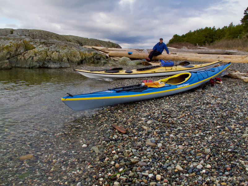
There are a few good launch points along the Oak Bay coast that give access to Chatham and Discovery, but one of the most popular and interesting launch spots is a small sheltered bay just to the left of the Oak Bay Marina and right of Queens Park on Beach Drive. There is a small beach located here and a boat ramp. You can park on the street right in front of the bay. This route will take you out through the Great Chain islands, a beautiful series of approximately 18 rocky islets, which are part of the Oak Bay Ecological Reserve. If you are going to rent kayaks or standup paddleboards, Ocean River Sport’s Oak Bay Paddle Shack is located right at the Oak Bay Marina.
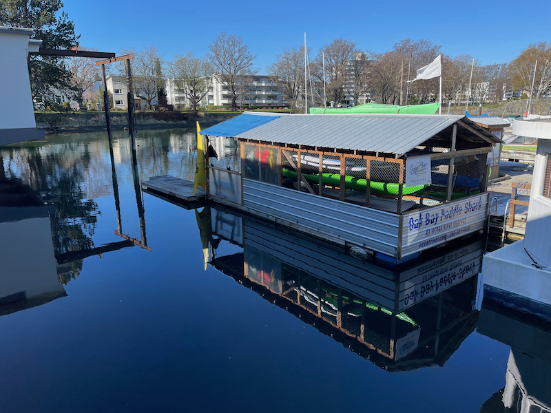
Oak Bay Paddle Shack
Other Launch Sites to Discovery Island Present More Challenges
There are other launch sites around the Oak Bay coastline, but this route avoids crossing Baynes Channel which, while a shorter crossing, has much more significant current flows of up to 6 knots. Leaving from Willows Beach or Cattle Point means longer open water crossings and potentially sets you up to paddle against adverse current flows. Leaving from the Oak Bay Marina sets you on a route which directly crosses the currents of the main channels, and allows you to island hop your way to Chatham & Discovery. This is a preferable solution, as you minimize your time exposed to open water crossings and adverse currents. However, strong currents may still have to be negotiated.
Check the Weather and Currents
It is critical that you check the weather, particularly the forecast for wind strength, direction and any predicted changes. You will also need to check the currents, their strength and predicted changes. We have created another post which will tell you exactly how to do this at this link: Planning a Kayak Trip to Discovery Island.
Wildlife
In addition to the bird colonies found on the Great Chain Islets, you will be impressed by the marine wildlife that may be seen along the way, including seals, sea lions, river otters, and bald eagles. At one time there was even a resident wolf, Takaya, who lived here. Local artist, Paul Archer, has painted a mural on the fog horn building at the light station in honour of Takaya.
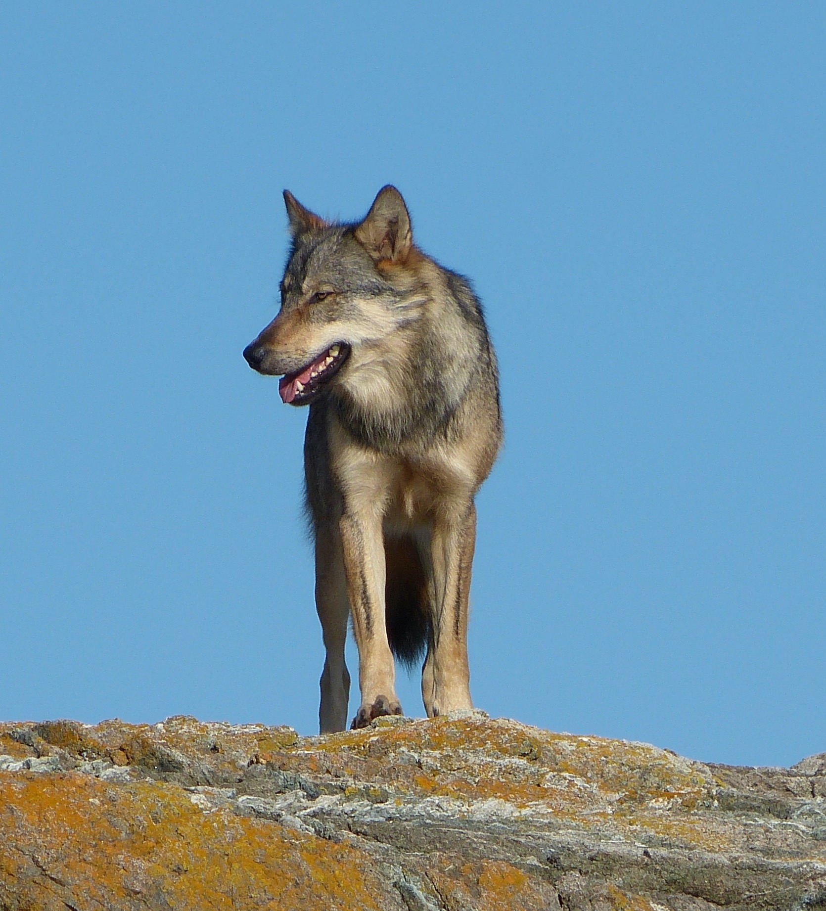
Takaya – the Discovery Island Wolf
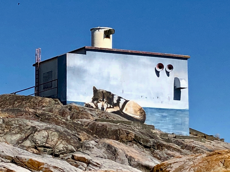
Wolf Mural on the Discovery Island Light Station Fog Horn Building
Cheryl Alexander, a local conservationist, photographer, author and filmmaker has studied and documented this unique wolf for years. She has documented Takaya’s journey in, his life on the islands and the development of their deep connection in her book Takaya: Lone Wolf , along with a stunning collection of her photography. Cheryl has also made a movie of Takaya which has been broadcast on CBC and BBC.
The Route
Once you leave the beach at the marina, paddle out along the docks turning right as you pass the last dock. You will see an opening in the breakwater in front you. Head for the opening keeping an eye out of other boaters. On your left you will pass by Mary Tod Island, which was once inhabited by an infamous sole by the name of “Jimmy Chicken” in the early 1900’s, (the island was commonly referred to as “Jimmy Chicken Island”). It is now a park where remnants of an old well and some foundations are still visible.
Once you pass through the breakwater you will see the Chain Islands in the distance. Directly in front of you is Harris Island, and once there you will be on the edge of Mayor Channel. This is a good spot to stop and judge the conditions and check boat traffic in the channel before setting off towards Great Chain Island. When crossing Mayor Channel, the currents will most likely force you to ferry glide, (set your boat angle to adjust for the current), so that you can aim for Great Chain Island. The angle you set will depend on the speed and direction of the current running at the time.
If you would like to learn more about currents, their interaction with the wind, how to paddle in them, and how to plan your route around them, check out our courses. Kayak Courses
Great Chain Island is the largest of this group of islands and unlike the other islets, supports grass, and a variety of plants and shrubs. The Chain Islets also support a significant breeding population of Glaucous-winged Gulls, Double-Crested Cormorants and a migratory population of Brandt’s Cormorants. As well, Pigeon Guillemots and American Black Oystercatchers nest on the islets, and Harlequin Ducks occur seasonally among the reefs and islands.
Landing on Great Chain Island or any of the other islets is restricted in order to protect sensitive wildlife, plants and ecosystems. Permission to land is required.
From Great Chain Island you can now pick a route through the rest of the islets as you head for Discovery Island. The Chain Islets are fun to poke around with lots of interesting currents swirling among them at times. The look and feel of the islets change dramatically with the rise and fall of the tide as more or less of the islets become exposed, so it is always a little different.
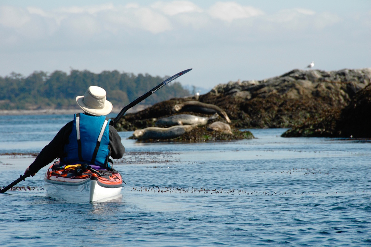
Harbour Seals resting on the rocks in the Chain Islands
Please remember, that these habitats are extremely sensitive to human disturbance please keep your distance from any wildlife roosting or resting on the islets.
Once, you are through the islets you will be facing Discovery Island with Plumper Passage crossing in front of you. Discovery is the outermost island to the right and Chatham is the large island to the left. Depending on the direction and the speed of the current flowing through Plumper you will be best to ferry glide straight across the channel and get into the slower water and eddies near the shoreline before continuing out and around Discovery Island.
The northern portion of Discovery Island, all of Chatham Island and most of the smaller islands nearby are First Nations Reserve lands under control of the Songhees First Nation. Please respect these areas and do not land anywhere on these islands (the area is patrolled and fines can be levied for trespassing). That being said, the channels and passages between these beautiful islands make for some excellent exploration.
There are lots of fun channels to explore around Chatham Island
Once across Plumper Passage, head south along the shore and around Commodore Point, entering Rudlin Bay. If you stay tight to your left as you paddle into the bay there is a nice pocket beach where you can land on the inside of Commodore Point. It is generally quite protected from waves here. There is a larger coarse sand and pebble beach further along the bay. Above this beach is a large open field where the campsites, picnic tables, information shelter and a pit toilet are located.
Lunch stop on the east side of Discovery Island
Discovery Island Marine Provincial Park is open year round. There is a camping fee and services provided from May 1 – September 30. During the off-season, there is no fee and no services. Fires are prohibited on Discovery Island at all times.

Discovery Island Provincial Marine Park
Enjoying the views at Discovery Island Marine Park
It is worth landing here and having a look around. There is a nice hiking trail running from western shore of the park to Sea Bird Point on the east side, where the Discovery Island Lighthouse is located. This structure was built in the 70’s and was fully automated in 1996. Near Sea Bird Point you can hike up Pandora Hill, only 125’ high, but gives you sweeping views of the Olympic Mountains and surrounding area. If you are here in the spring, a colourful abundance of wildflowers bloom in the woodlands and meadows.
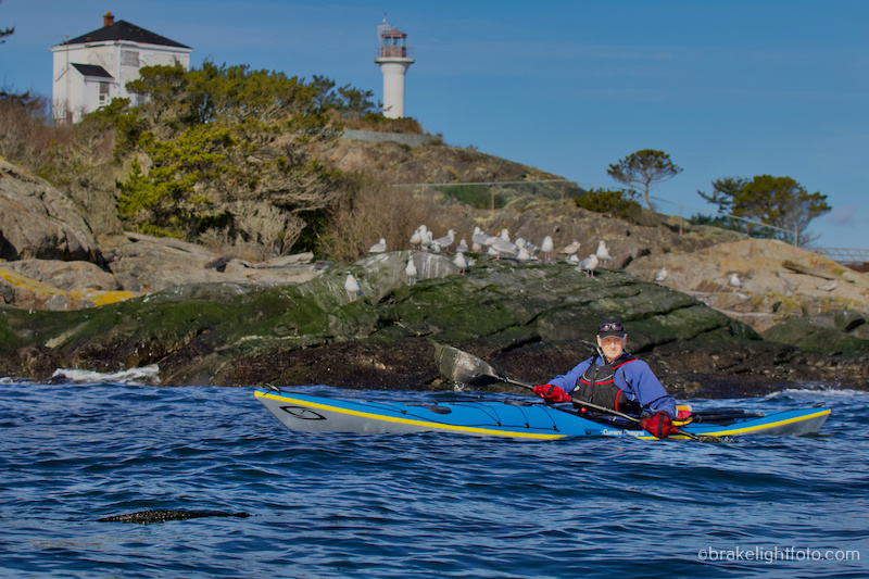
Sea Bird Point and the Discovery Island Lighthouse
Once you ready to leave the park, continue your paddle east around Sea Bird Point and back into the channel between Discovery and Chatham. It can get quite shallow through here at low tides and sea life is easily visible beneath you as you paddle through. Alternatively, and depending on your time, you can continue out around Chatham and come back through the various channels between the islands from the Baynes Channel side. These are fun places to explore.
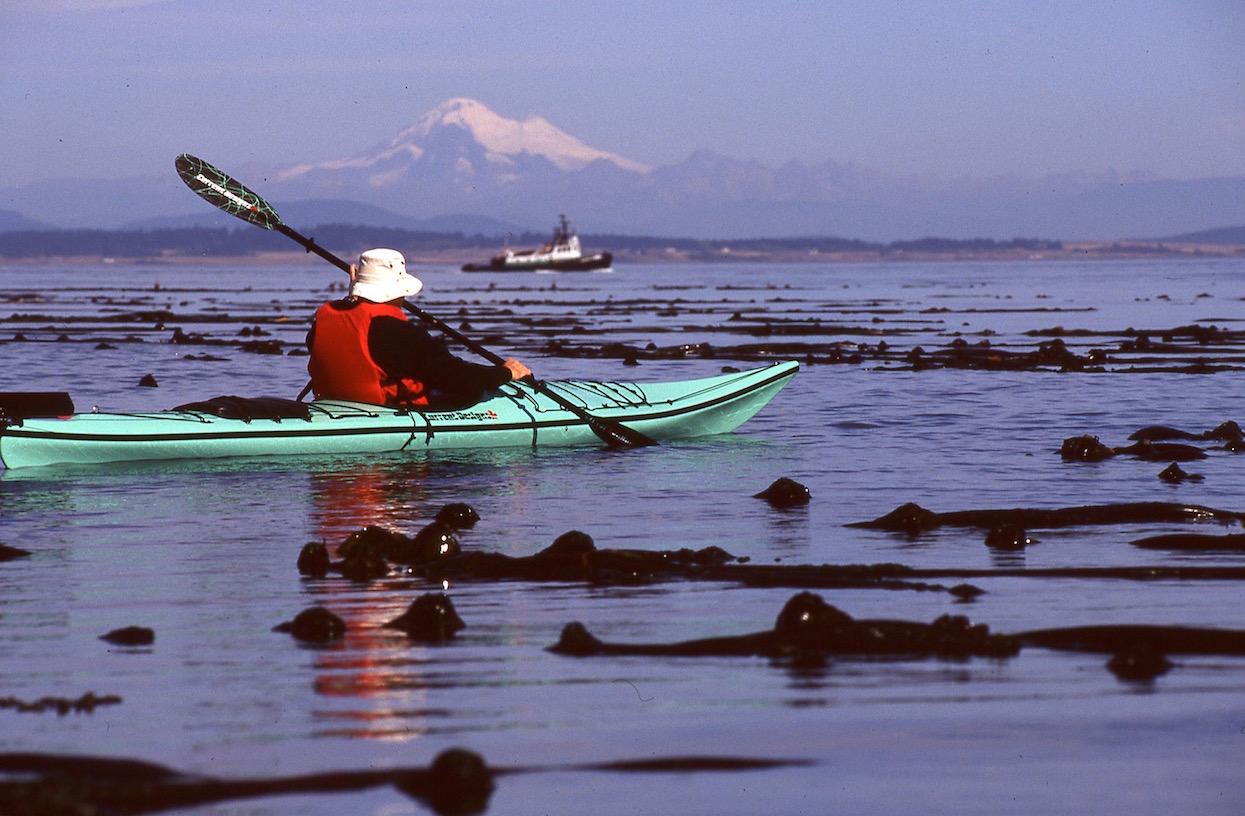
Off the southeast end of Discovery Island, Mt Baker in the distance
For your return trip we recommend you return the way you came, so come back out the channel between Discovery & Chatham and cross Plumper Passage back to the Chain Islets. Then work your way back to the Marina. It is best to avoid the temptation to take the strait line back to Oak Bay Marina, particularly if the currents are flooding due to the increased exposure to the main channel.
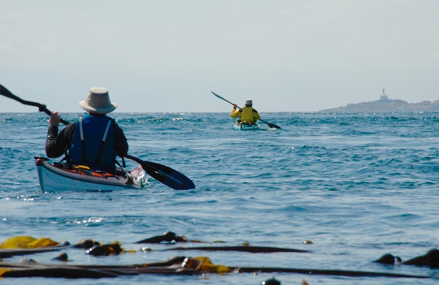
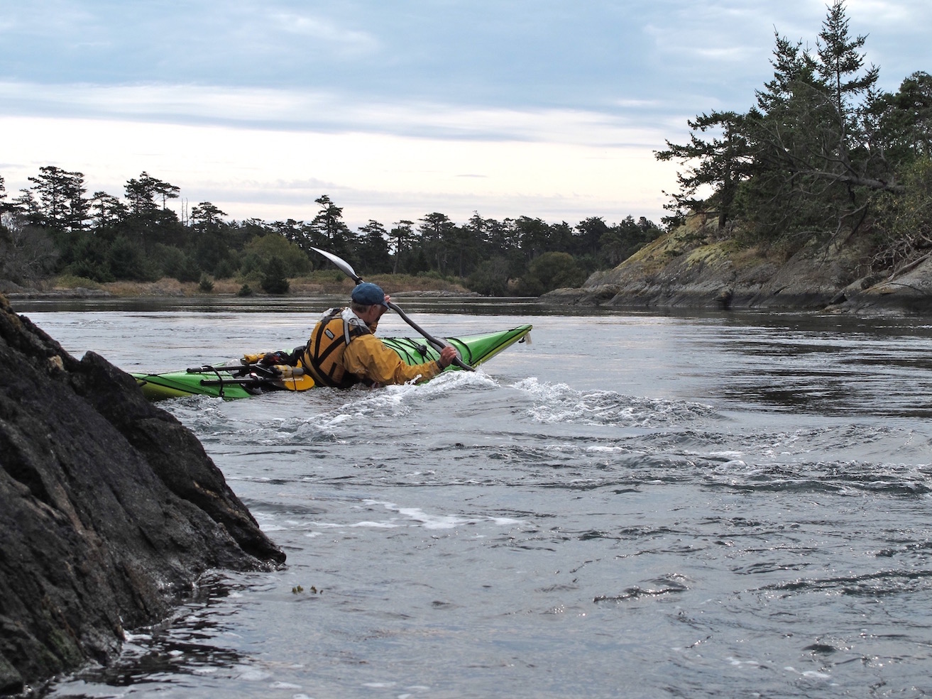
Leaving Discovery Island into tide rips in Plumper Passage
On your return, keep a close eye out for boat traffic in the main channels and coming in and out through the breakwater at the Marina.
Safe Paddling!!
For more detailed information of how to check the Weather and Currents for this trip check out our post, Planning a Kayak Trip to Discovery Island.
Safe Paddling!
Bruce Holland – You can also catch me at Ourhomehas6wheels.com or Brakelightfoto.com
… [Trackback]
[…] Read More on|Read More|Read More Infos here|Here you will find 61435 more Infos|Infos on that Topic: oceanriver.com/paddling-chatham-discovery-island/ […]