Kayaking Routes around Victoria: McNeill Bay to the Trial Islands
The Trial Islands are located in the Strait of Juan de Fuca just off the shores of Oak Bay. There is easy access to the water and parking at McNeill Bay. It is an excellent short day trip, which can easily be accomplished within 1 or 2 hours. Caution should to be exercised when planning a trip here. Strong currents of up to 3 knots can be found in Enterprise Channel, which separates Trial Island from McNeill Bay, and even stronger currents of up to 6 knots occur off the south end of the island. It is a trip best suited for intermediate to advanced paddlers. Please see the trip planning section of this post for more details.
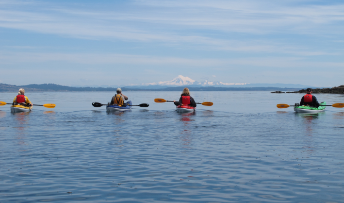
Trial Island and the Olympic Peninsula
The name for the Trial Islands likely came from the early days of the British Navy in Victoria when refitted sailing vessels were sailed from Esquimalt Harbour to Trial Island to test the seaworthiness of the repairs. The Trial Islands are now an ecological reserve, created in 1990, to protect one of the most outstanding assemblages of rare and endangered plant species found in British Columbia. 28 species are listed as rare and 15 are listed as greatest rarity. Because of this, landing on the Trial Island Ecological Reserve is restricted and permission to land is required. The reason for the abundance of rare plant species found here is because the islands escaped glaciation during the last ice age.
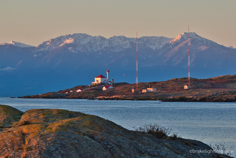
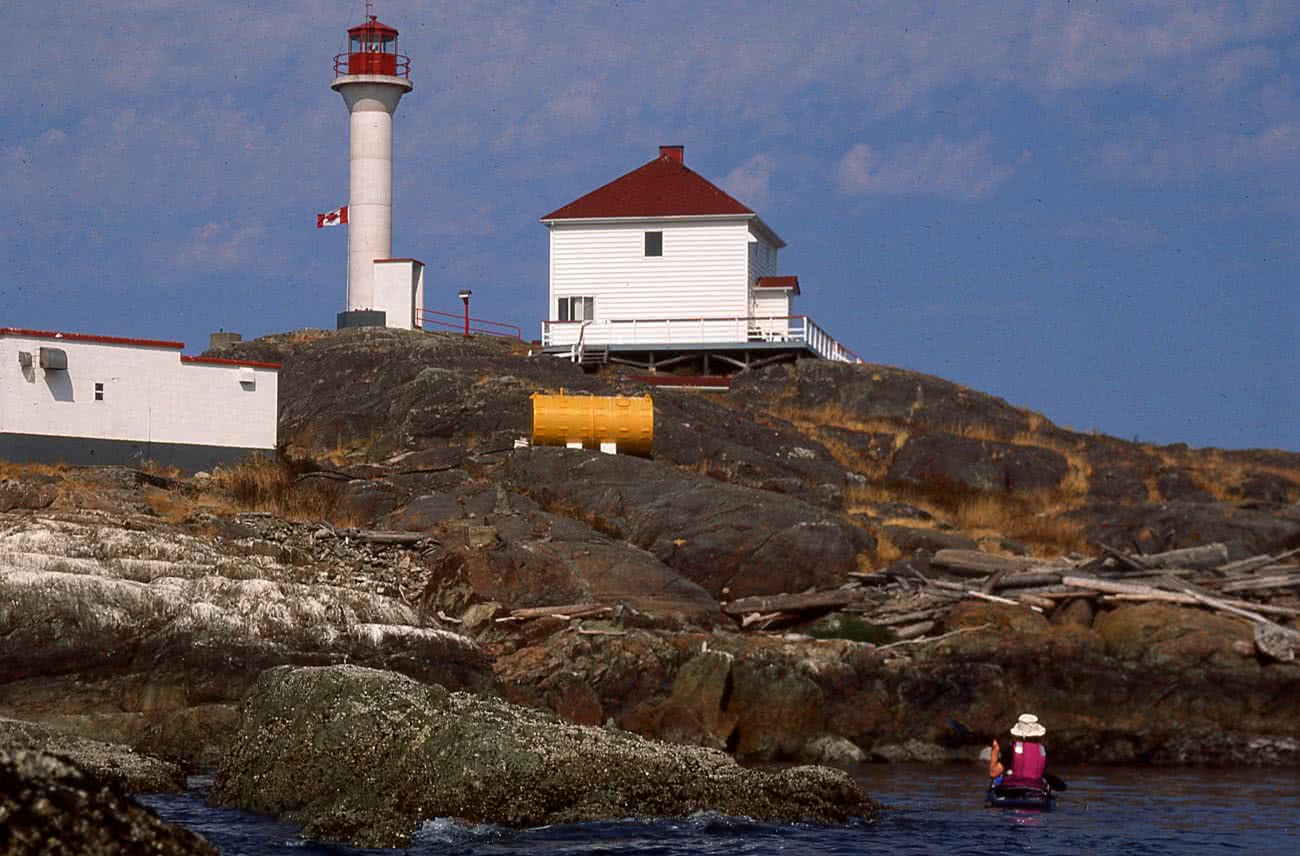
The Trial Island Lighthouse on the south east tip of The Trial Islands
The lighthouse found on the southern tip of Trial Island was built in 1906 and was fully automated in 2009. For more information on the lighthouse check out the post for: Friends of Trial Island Lighthouse.
Launch Location
McNeill Bay, right along Beach drive in Oak Bay, offers the easiest access to the Trial Islands. There is a small pocket beach in the left corner of the bay giving a very easy and sheltered access to the bay. You will find a staircase going down to the beach. This is a preferable launch spot to the main beach on McNeill Bay, which is more exposed to wave action and can be covered at some high tides. For a slightly longer paddle, you could also launch at Ross Bay, off Crescent Rd.
The Route
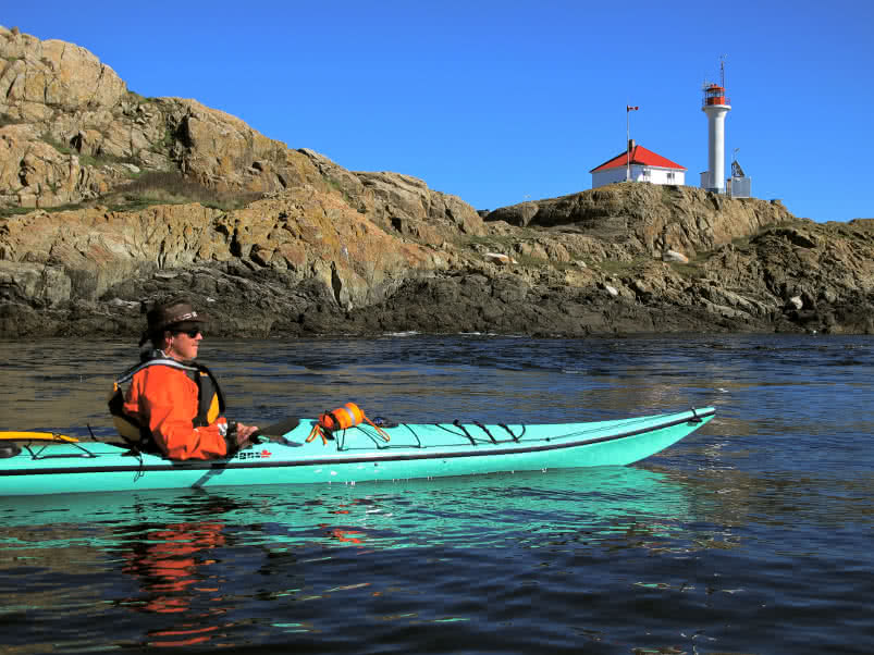
Trial Island Lighthouse
The total paddle route is approximately 4.2 km or 2.27 nautical miles. Plan 1 to 2 hours for this trip depending on how much time you spend sightseeing, socializing and playing in the currents.
The key to picking a route to the Trial Islands is knowing which way the currents are flowing. If the currents are flooding (flowing west to east), your best route will be to cross high above Enterprise Channel and ferry glide over to the west side of the islands. This will set you up to ride the current around the southern tip of the islands, should you decide conditions are safe to do so. The largest rips will be found on the flood at this location. A very large eddy forms on the south end of Trial, which can give you a good ‘sneak’ route past the rips, but be careful of the strong eddylines. On your way back, you can work your way up against the currents between the two islands back to Enterprise Channel and ferry glide back to McNeill Bay.
If the currents are ebbing (flowing east to west), depending on the strength of the current, you can once again ferry glide to the west side of the islands, then work your way down between the two islands with the current or you can let the current of Enterprise Channel carry you down to the east side of the islands. Work you way up the shore and ride the current around the southern tip. Paddle back along the west side of the islands and ferry glide back across Enterprise Channel to McNeill Bay.
Wildlife
There is a wide variety of sea birds found on the islands, there has been a nesting pair of bald eagles, and even a couple of snowy owls have made a winter residence of the islands on occasion. You will see harbour seals, river otters and if you really lucky you might see a pod of orcas, a grey whale or humpback whale passing by.

Grey Whale off Trial Island
Planning the Trip
You will potentially run into tide rips in Enterprise Channel and off the southern tip of Trial Island as well as the channel between the two main islands. While you can plan your crossing from McNeill Bay to avoid the Enterprise Channel, you should still be aware of the direction and speed of the currents so you will know which way you are going to drift as you cross to the islands.
Check the weather forecast
Most importantly, check the winds (speed & direction) forecast for the day at the sites posted below. Our recommendation for most paddlers is to keep the winds under 10-12 knots or 18 – 24 kph. . Remember that wind against the current will create larger, steeper waves. Make sure you are aware of the current and wind changes that will occur later in the day on your return trip. What was a nice calm crossing with light winds in the morning may change to steep breaking waves with a change of current direction in the afternoon.
Here are 2 recommended sites for good wind forecasts:?
Check the Currents for Trial Island
As we have already mentioned, it is important to be aware of the currents flowing around the Trial Islands not only for the hazard that strong can directly pose, but for the quick changes in wave conditions that can occur when currents change direction and flow against the wind.
It is important to distinguish the differences between tides and currents. Tide stations measure the depth of the water at high and low water at a particular location. A current station, on the other hand, measures the speed and direction of the water moving past a location. Also be aware that times of high and low tide do not correspond to changes in current direction, so you cannot use tide tables to predict currents. This is particularly relevant around southern Vancouver Island.
Warning: If currents are running more than 2 knots in Enterprise Channel, caution should be exercised, as tide rips will occur here. There is also a likely possibility of wind against current, creating larger steeper waves. As well, strong eddylines (the transition between the main current and slower water near the shoreline) can easily capsize unwary paddlers.
Checking the Currents with Aye Tides Phone App
1. The easiest way to check the currents is with a very convenient phone app called Aye Tides. Just click ‘Find a Station’ and select Race Passage. This is the closest ‘main current station’ to the Trial Islands. Currents in Baynes Channel, (between 10 Mile Pt and Chatham) run approximately half the speed of Race Rocks and do so 15 minutes earlier, regardless of the direction of flow. The currents in Enterprise Channel run approximately half that of Baynes Channel, so you can approximate what the currents are doing from this data.

Rounding the south tip of Trial Island with Mt Baker in the background
Checking the Currents with the Canadian Tide & Current Tables
2. The Canadian Tide and Current Tables can be accessed online. Go to the listing for Race Passage on page 68,this is the closest ‘main current station’ to the Trial Islands. The times of the turn to Ebb and Turn to Flood (essentially slack water), as well as the time of the maximum current flow are listed. The minus sign refers to the ebb or water flowing out (a westward direction at Race) and the positive sign is the Flood or inflow (eastward). Once you have this information, you can now use the ‘secondary current stations’ listed on page 135 to find a listing for Baynes Channel (this is the closest secondary current station to Trial Island). This chart will tell you that Baynes Channel runs at about 75% of Race Passage and 15 minutes earlier. For example, if the currents are 4 knots at Race, expect 3 knots in Baynes Channel. You can further fine tune the forecast by checking the nautical charts of the area where you will find the currents in Enterprise Channel run about half the speed of Baynes Channel. Therefore, the current in Enterprise Channel will be running around 1 1/2 knots in our example.
4. Feel free to check in with the staff at the Adventure Center either by emailing us at adventure@oceanriver.com, or phone at 250-381-4233 and we will be more than happy to help you out with your trip planning and supply you with any of the gear you may need for your adventure including boat and equipment rentals. If you would like to upgrade your paddling and/or navigational skills so you can safely participate in trips like this and learn more about paddling in currents and rough water, check out our awesome Kayak Course Curriculum.
Other weather considerations
Fog: Fog can form at any time of year around the Trial Islands, but it is more prevalent through the months of August and September. Sea fog forms here as a result of warmer air meeting the colder waters of the Juan De Fuca Straits. Fog can roll in quickly and completely obscure visibility. As a result you should be prepared with a compass and chart and/or a GPS so you can safely navigate your way back. If you are using a compass, keep in mind you will have to compensate for drift caused by the current. Also, be aware that unlike radiation fog, which forms over land in calm air conditions, sea fog can be associated with high winds.
Water Temperature: The waters here are cold all year round with average winter temperatures running 7.0-8.0?C (44.5-46.5?F) and only warming to 10-11.5?C (50-53?F) from May through October. In waters this cold exhaustion can occur in 30-60 minutes or less and survival times are between 1-3 hours.
Waves The Trial Islands are quite exposed to the Straits of Juan de Fuca, so there is the potential for large waves and swell and the potential for rebound waves off the cliffs on the southern tip of Trial Island which can create very confused sea conditions, particularly when combined with the tide rips that can be found here.
It is imperative that you:
1) Have the necessary skills to paddle the rough water conditions that can be experienced here, including assisted and self rescues.
2) Do the necessary trip planning to avoid potentially hazardous conditions and keep in mind that conditions here can change rapidly, so once on the water, be aware.
3) Wear the appropriate clothing, ie dress for the water temperature.
4) Have the necessary rescue equipment with you including signal flares and some form of communication device such as a cell phone in a water proof case (make sure you can operate it in the case) , a VHF radio, Personal Locator Beacon (PLB) or satellite messenger such as the Spot or inReach. Make sure all your devices are fully charged and the batteries are good. They could save your life! Click this link to see a full review of Electronic Communication Devices.
How to get there
From Downtown Victoria, drive up either Pandora St or Fort St and turn right on to Cook St, turn left onto Fairfield Rd continue onto Beach Drive. You will come to MacNeill Bay, which is in the 500 block of Beach Dr. Drive to the far left side (east side) of the bay and park on the street.
Safe Paddling!
Bruce Holland – You can also catch me at Ourhomehas6wheels.com or Brakelightfoto.com