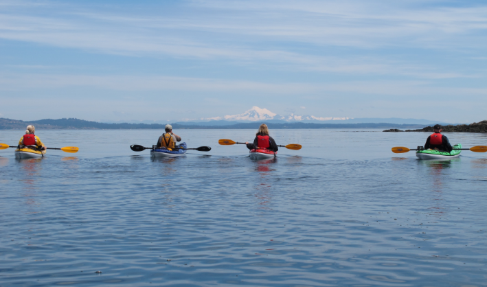
A Kayaking Trip to Race Rocks Lighthouse and Ecological Reserve
Race Rocks is located just one nautical mile off the southernmost tip of Vancouver Island. It is an archipelago of low rocky islets lying in the narrowest point of the Straits of Juan de Fuca. Washington State’s Olympic Peninsula is only 22 km (12 nautical miles) away. Race Rocks is aptly named for the strong currents and rough water conditions that can be experienced here. This spectacular day trip is only recommended for intermediate and expert paddlers who have taken the time to do the necessary trip planning.
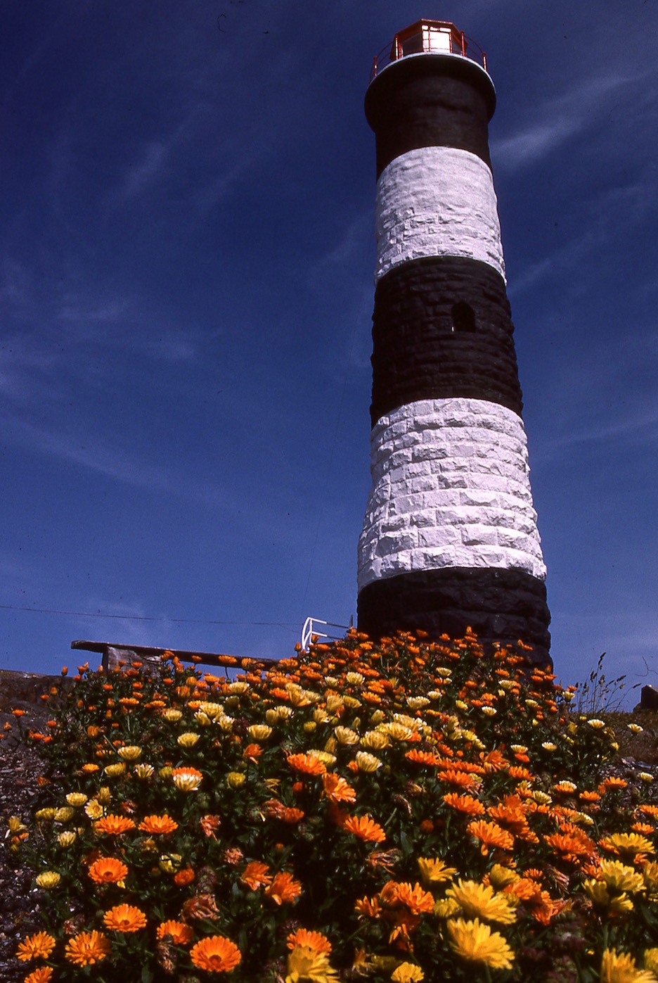
Race Rocks Lighthouse
Race Rocks is the second oldest lighthouse on BC’s coast. Only Fisgard Lighthouse, located at the entrance to Esquimalt Harbour, is older and only by 6 weeks.
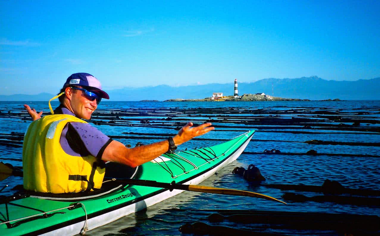
Race Rocks Lighthouse & Ecological Reserve
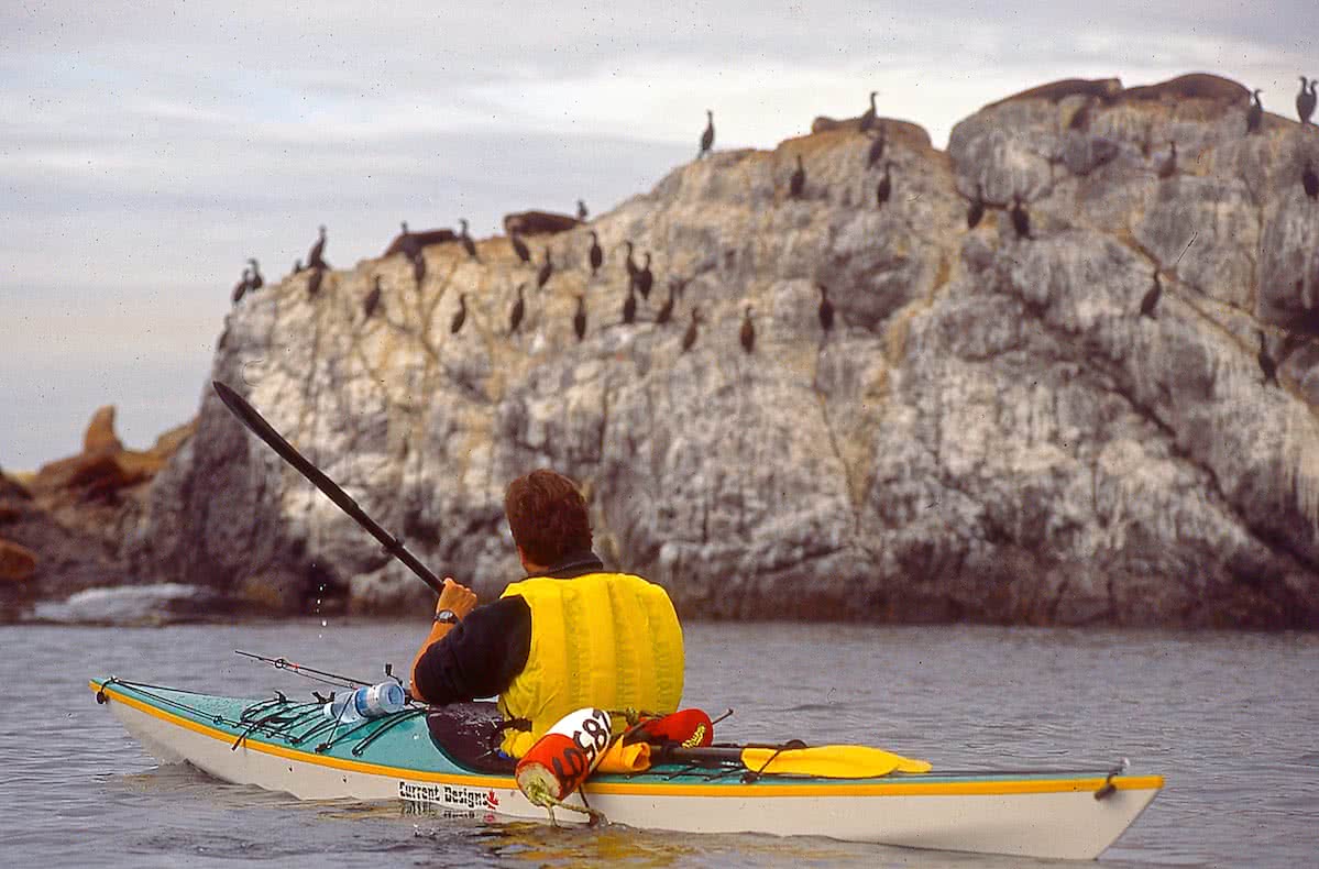
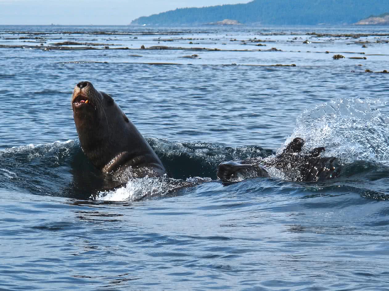
The lighthouse at Race Rocks is a beautiful historic landmark, in itself worth the paddle. However, the waters and the many islets surround Race Rocks lighthouse are an incredible showcase of Pacific marine life with sea mammals, seabird colonies and an a amazing array of underwater plants and animal life. This is partly due to the isolation of these low lying islets, but is also due to the incredibly rich and diverse underwater habitat created by cold nutrient-rich waters being forced to the surface and the fast-moving waters rushing through this narrow passage. It is a haul-out area for California and Northern sea lions and a birthing rookery for Harbour seals. It is also the most northerly birthing colony on the Pacific Coast of North America of elephant seals. It is certainly one of the most spectacular kayak day trips on Southern Vancouver Island!
History
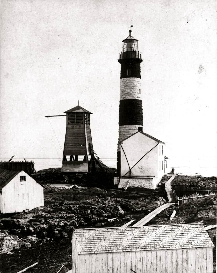
Race Rocks Late 1800’s –
BC Archives
All of the water that fills and drains the Salish Sea, which encompasses, Georgia Strait, Juan de Fuca Strait and Puget Sound, flow through this narrow constriction creating very strong current flows which can reach speeds of up to 8 knots! This, combined with the fact that this area is also exposed to the swells of the open Pacific, make Race Rocks a particular hazard to navigate and a potentially very dangerous area to kayak. It was for these reasons, and numerous marine tragedies here, that the British Admiralty decided to build a lighthouse at this location in 1860. The lighthouse was completed and lit for the first time on Boxing Day of 1860. The 24.4 m (80′) tower was primarily built of granite blocks which were sourced and cut locally. After the granite ran out they completed the top few meters of the tower with sandstone blocks quarried on Gabriola Island. If you look closely at pictures of the tower you can see this transition near the top. The tower is painted in large black and white bands, which was started by the first lighthouse keeper in order to improve the visibility of the tower against the shoreline during daylight, particularly when being viewed from the west. The last lightkeepers left here in 1997 at which time Lester B. Pearson College took over the management of the station and the surrounding Race Rocks Marine Protected Area. The lighthouse has been automated ever since.
First Nations
In spite of Race Rock’s hazardous and exposed location, there is evidence found on the main island that The First Nations people used this unique area in the past. There are several stone mounds that suggest they used this area for burials in the period around 500 AD. There are over 400 similar sites that have been found on nearby Rocky Point. There is also an old dugout canoe on the main island, brought from another location, which gives a focus for the way of life experienced by the First Nations people who inhabited this area.
Race Rocks Ecological Reserve
Maintain a Safe Distance From the Wildlife
The Race Rocks Marine Ecological Reserve was first started as a marine science project by the students of Pearson College in 1978. Two years later it became Ecological Reserve #97 under BC Provincial Parks protection. In 1998 it was designated as a Canadian Marine Protected Area by the federal government of Canada. It is now managed by the staff and students at Pearson College and is available as a resource for education and research. The reserve covers 3 square kilometres of ocean, rocks, and reefs, but does not include the small area of land where the lighthouse and foghorn are situated. That area is leased by the Canadian Coast Guard.
Interesting things to See, Avoid & be Aware of on the Way to Race Rocks
Passing Pearson College in Pedder Bay
Lester B Pearson College: If you leave from Pedder Bay Marina, you will see the Lester B.Pearson United World College of the Pacific, beautifully situated on the hillside on your left. The campus is hardly noticeable, hidden in the trees as it is. It is one of fourteen United World Colleges located around the world. It is named after the late Canadian Prime Minister Lester Bowels Pearson, winner of the 1957 Nobel Peace Prize, and early supporter of the College. The mission statement of the UWC Colleges and of the school is to “make education a force to unite people, nations and cultures for peace and a sustainable future”. The college follows the International Baccalaureate curriculum, which covers the final year of high school and a pre-university year. Up to 100 students a year attend Pearson College hailing from nearly 90 countries.
Ministry of National Defence Lands (MND): On your right, you will pass by Canadian Forces Ammunition Depot Rocky Point. You shouldn’t land anywhere along here, and you should definitively not trespass beyond the high tide mark.
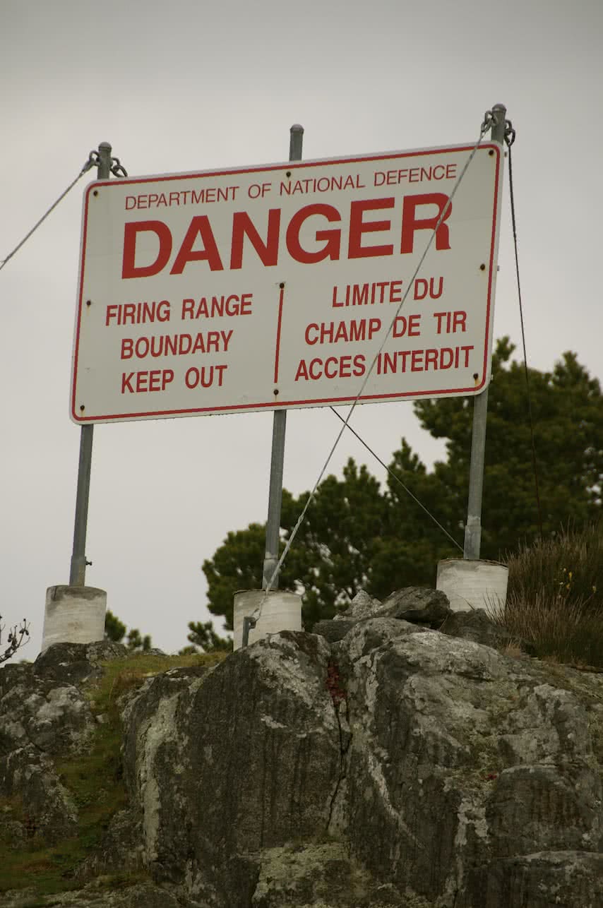
Bentink Island Warning
Bentinck Island (MND): Bentinck Island, also MND land, is the last point you pass before entering Race Passage. Bentinck Island is used for explosive’s demolition and is well signed as such. Do not land anywhere on this island, including low tide beaches. That being said, the passage between Bentinck and Rocky Point is beautiful and well worth the detour. Using this passage can also set you up for a crossing higher or lower in Race Passage.
Bentinck Island served as a leper colony from 1924 – 1957, and was built to replace another leper colony located on D’arcy Island, in Haro Strait just off Island View Beach. The colony was moved to Bentinck Island because it was closer to the medical quarantine facilities located at William Head Station (1872-1959). The colony was shut down after the last person died there in 1957. Another notable event concerning Bentinck Island was the Holland America cargo liner Eemdijk, which ran aground on Race Rocks on October 15, 1925. She was refloated and beached on Bentinck Island. The tug boat Hope and her crew of seven men were lost attempting to salvage the liner.
William Head Institution: The last point of land that you pass on your left is William Head. This is a federal minimum security penitentiary which encompasses the entire point. Do not attempt to land anywhere on this point.
Race Rocks Ecological Reserve: Since Race Rocks is an ecological reserve extra care must be taken when visiting this sensitive area. Ecological Reserves are areas in British Columbia selected to preserve representative and special natural ecosystems, plant and animal species, features and phenomena. Ecological Reserves provide the highest level of protection for the maintenance of physical and biological diversity while allowing for research and educational activities.

Race Rocks Light Station
The Race Rocks Light Station: The light station includes two residences, formerly used by the light keeper and his assistant, a dock and boathouse, a concrete block building housing the diesel generators and foghorn, fuel tanks, a helicopter pad and of the course the lighthouse itself. In days gone by, there used to be a stone house attached to the tower, very similar to the one found on Fisgard lighthouse. It was said to have been incredibly damp and drafty and was finally torn down in early 1960’s. The main tower is quite interesting and when you go inside you will see the spiral staircase made from sandstone cylinders, which also forms a central column in the tower. Painted on the steps you can see the location of a square hole which was the channel created for the passage of the weights and cables that used to mechanically rotate the light in the early days. The light keeper would have to crank the weights up to the top of the tower, then they would slowly drop, turning the light. The original light floated on a bath of mercury to reduce friction. You may have heard stories of mad light keepers or “mad as a hatter”, as light keepers, just like the hat makers who used to use mercury in their trade, were adversely affected by the poisonous vapours given off from the mercury.
For a full history of Race Rocks Lighthouse click this link: History of Race Rocks.
See the map at the bottom of this article for locations of these points of interest.
Guidelines for Paddling Around Race Rocks
For complete guidelines please visit the Race Rocks Ecological Reserve website. The Race Rocks Eco-guardians recommend common sense as your guiding principle when paddling around the islets at Race Rocks. The guardians try to restrict any activity which may cause birds and mammals unnecessary disturbance. Unnecessary movement for the wildlife means extra energy expenditure, and this means more stress for food gathering and territorial activities. The Eco-guardians have observed that people with the best of intentions often compromise the well-being of the wildlife in order to get closer for a better look or a better photo. The recommended guideline for approaching islets with mammal haul-outs and bird colonies is 100 meters (109 yards).
Curious Sea Lions may follow you around Race Rocks
The Race Rocks Eco-guardians remind us that boat access, (including kayaks), around the islands can jeopardize the integrity of parts of the reserve. As kayakers, we all like to think that our choice of water-craft is very eco-friendly, but observations have shown that the stealthy nature of kayaks can be more disruptive to wildlife because they can take them by surprise. One area of particular concern at Race Rocks is the cliff beneath the helipad where cormorants roost. This area should be well off-limits for any boat approach and you should only use the centre of the channel through here. Cormorants take flight very easily and when their eggs are left exposed, it leads to increased predation by crows and seagulls. Other sensitive spots include the seal pupping areas in the channel directly to the South of the tower from June to August. This area is off limits to boats during these months. A reminder, that Harbour seals are easily spooked at any time of the year when kayaks approach.
Due to the unpredictability of the activities and locations of animal haul-outs or bird nesting, the advice of the Race Rocks Eco-guardian should always be sought before trying to access the islands. Click here for Contact Information. If you are further interested in good guidelines for approaching wildlife please check out Friends of Ecological Reserves website.
Wildlife you can expect to see
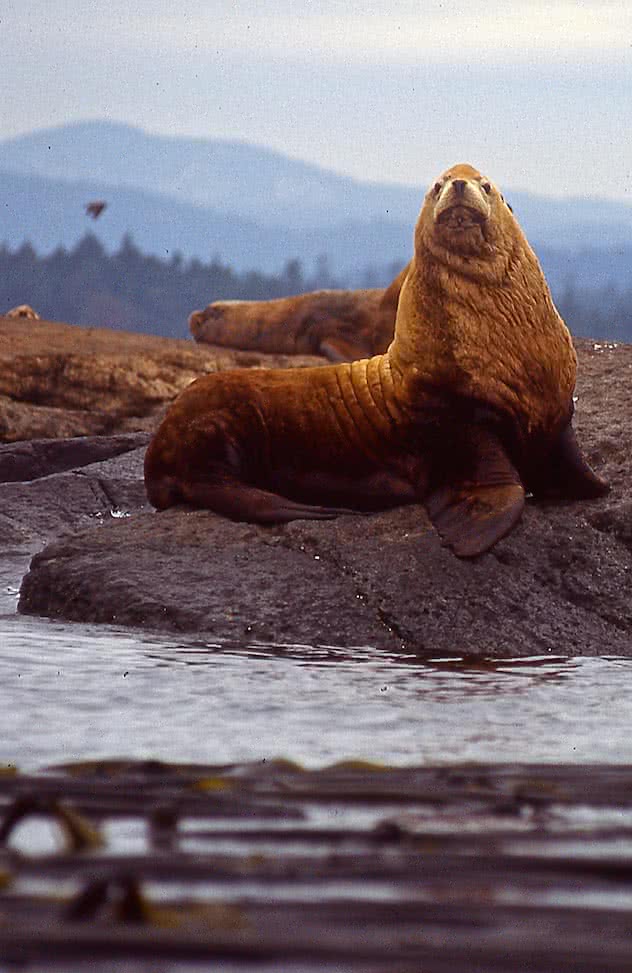
Northern Sea Lion
Among the mammals you are very likely to see are the Northern Sea Lions (formerly Steller Sea Lions), California Sea lions, and Harbour Seals. Rarer but commonly seen in residence are Elephant Seals. Other mammals seen in the waters around Race Rocks include Sea Otters, Orca’s, Grey Whales, Humpback Whales and Dall’s Porpoise.
Some of the birds you can commonly expect to see include: Pigeon Guillemot, Brandts Cormorant, Pelagic Cormorant, Double Crested Cormorant, various species of Gulls, Bald Eagle, Western Grebe, Black Oyster Catcher, Common Merganser, Harlequin Duck, Black Turnstone, Blue Heron and many more.

Cormorants
Trip Planning

Conditions Can Change Quickly
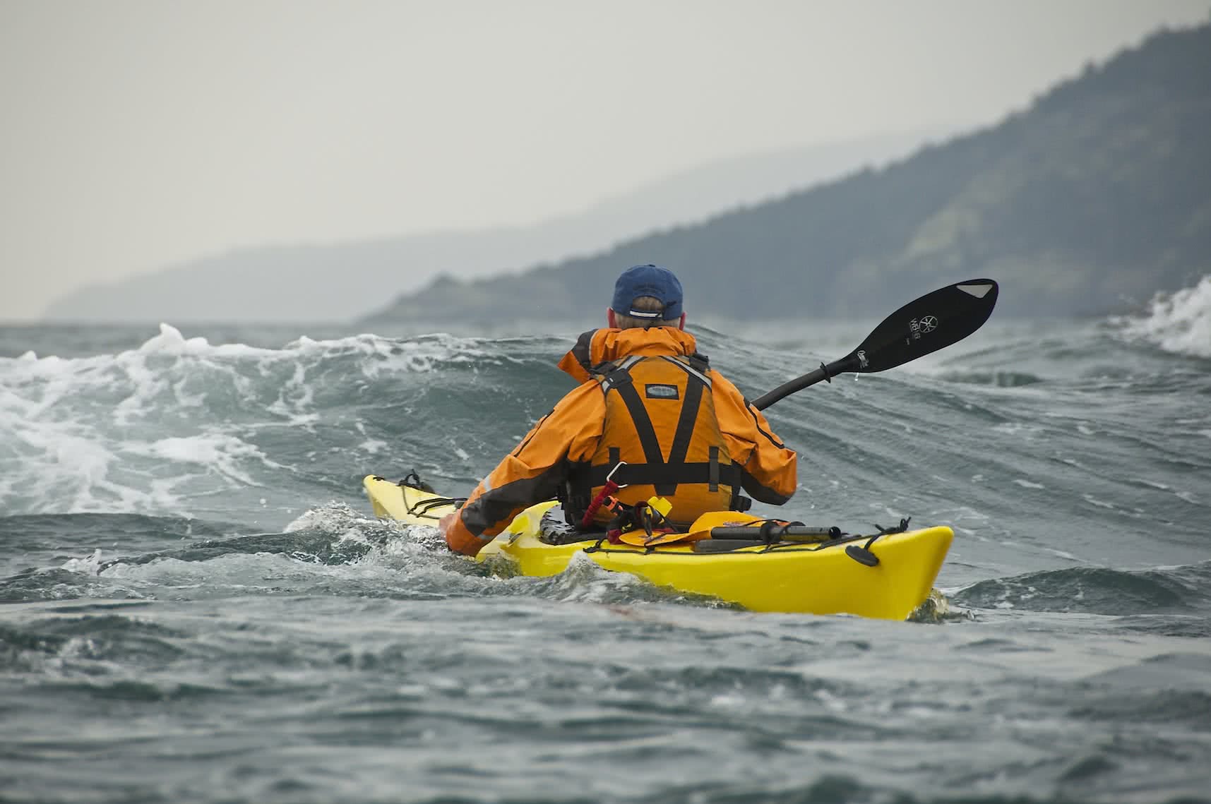
Warning: While the paddle from Pedder Bay Marina out to the mouth of Pedder Bay is a very beautiful and relatively protected paddle for novices, crossing the 1 nautical mile passage over to Race Rocks should only be attempted by experienced paddlers who have taken the time to do the proper trip planning and have the necessary paddling skills to handle the potentially hazardous currents and wave action that can be experienced here. Make sure you take the proper safety equipment including some form of emergency communication device.
Wind Against Current Can Quickly Change Conditions
If you are planning to cross Race Passage, you will have to check the forcasted winds and currents (note: if you are uncertain as to the difference between tides and currents, see below*). Strong currents of up to 8 knots can be experienced here. (Keep in mind that anything over 2 knots is considered strong). Unless you are an expert paddler going out to play in the rough water we recommend you paddle in currents of less than 2 knots.
The other very important consideration in an area like this is to understand the interaction between wind, waves and currents, namely that wind blowing against the current will create larger, steeper waves. The day Brian and I went, the winds were light, only 8 – 10 knots. However, they were blowing against a 1.8-knot flood which kicked up 1-1.5 m (3-4 ft) standing waves in the channels. Finally, you should understand that the time of slack water will become less and less as the currents become stronger and at very strong flows there may be only a few minutes of slack water. Keep in mind that while the tide and current tables are fairly accurate, they are still only estimates and are not exact.
Check the weather forecast
Most importantly, check the winds (speed & direction) forecast for the day at the sites posted below. Our recommendation for most paddlers is to keep the winds under 10-12 knots or 18 – 24 kph, and remember that wind against the current will create larger, steeper waves.
Here are 2 recommended sites for good wind forecasts:
Environment Canada Marine Forecast – Juan De Fuca Strait- Central Strait
Check the currents for Race Passage
1. The easiest way to do this is with a very convenient phone app called Aye Tides. Just click ‘Find a Station’ and select Race Passage. If currents are running more than 2 knots caution should be exercised. Strong eddylines (the transition between the main current and slower water near the shoreline) can easily capsize unwary paddlers.
2. Using the Canadian Tide and Current Tables. Use the online tables and find the listing for Race Passage (page 68). The times of the turn to Ebb and Turn to Flood (essentially slack water), as well as the time of the maximum current flow are listed. The minus sign refers to the ebb or water flowing out (a westward direction at Race) and the positive sign is the Flood or inflow (eastward).
*The differences between tides and currents. Tide stations only measure the depth of the water at high and low water at a particular location. A current station, on the other hand, measures the speed and direction of the water moving past a location. Also, be aware that times of high and low tide do not correspond to changes in current direction, you cannot use tide tables to predict currents, particularly around southern Vancouver Island.
4. Feel free to check in with the staff at the Adventure Centre either by emailing us, or phone at 250-381-4233 and we will be more than happy to help you out with your trip planning and supply you with any of the gear you may need for your adventure including boat and equipment rentals. If you would like to upgrade your paddling and/or navigational skills so you can safely participate in trips like this and learn more about paddling in currents and rough water, check out our awesome kayak course curriculum.
Other weather considerations
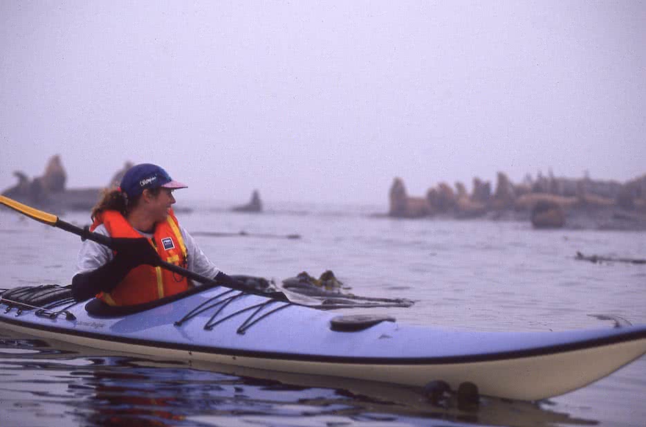
Paddling in the Fog at Race Rocks
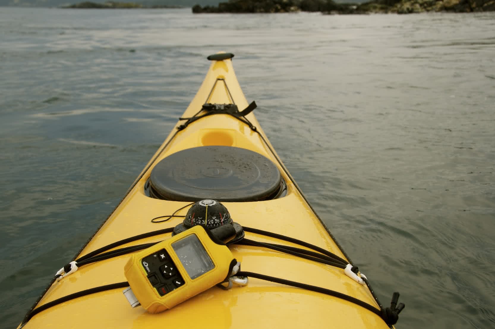
Fog: Fog can form at any time of year at Race Rocks, but is more prevalent through the months of August and September. Sea fog here forms as a result of warmer air meeting the colder waters of the Juan De Fuca Straits. Fog can roll in quickly and completely obscure visibility. As a result, you should be prepared with a compass and chart and/or a GPS so you can safely navigate your way back. If you are using a compass, keep in mind you will have to compensate for drift caused by the current. Also, be aware that unlike radiation fog, which forms over land in calm air conditions, sea fog can be associated with high winds.
Water Temperature: The waters here are cold all year round with average winter temperatures running 7.0-8.0?C (44.5-46.5?F) and only warming to 10-11.5?C (50-53?F) from May through October. In waters this cold exhaustion can occur in 30-60 minutes or less and survival times are between 1-3 hours.
It is imperative that you:
1) Have the necessary skills to paddle the rough water conditions that can be found in Race Passage, including self and assisted rescues.
2) Do the necessary trip planning to avoid potentially hazardous conditions and keep in mind that conditions here can change rapidly, so once on the water, be aware.
3) Wear the appropriate clothing, ie dress for the water temperature and the conditions.
Carry the necessary safety equipment
4) Have the necessary rescue equipment with you including signal flares and some form of communication device such as a cell phone in a waterproof case (make sure you can operate it in the case and the battery is charged), a VHF radio, Personal Locator Beacon (PLB) or satellite messenger such as the Spot or inReach. They could save your life! Click this link to see our full review of Electronic Communication Devices.
Personally, I really like satellite messengers, they are small, easy to use and not restricted by cell signals or the relatively short range of handheld VHF radios. While not as powerful or perhaps quite as reliable as a PLB, the Delorme inReach SE or Explorer can send a signal from anywhere in the world but they also allow you to be in communication with rescuers via a texting function as well as track your route.
How to get there
Departure from Pedder Bay
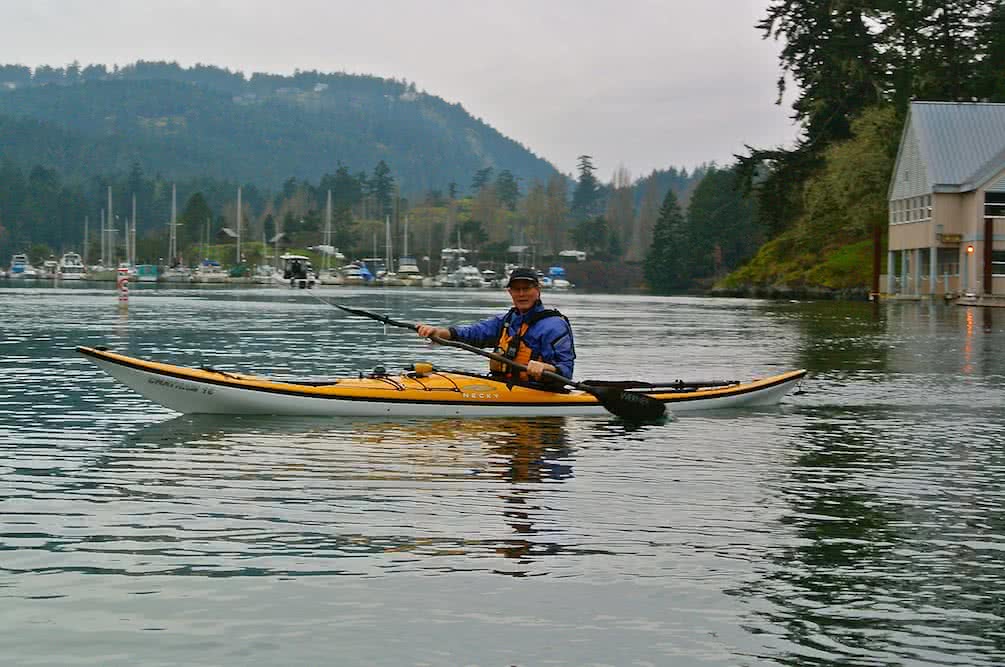
A great place to launch is Pedder Bay Marina off Rocky Point Rd in Metchosin. (There is a fee for launching kayaks at the marina). It allows easy access to the water and it is a nice sheltered paddle down Pedder Bay out to the edge of Race Passage. If you decide not to make the crossing it is still a very pleasant paddle. Optionally, you could leave from Weirs Beach off Metchosin Rd. It is a slightly shorter drive, but it is a more exposed paddle to Race Rocks. Finally, you could leave from Pearson College, but please check with the college for permission before doing so.
How to get to Pedder Bay:
Approximate driving time from downtown Victoria to Pedder Bay Marina: 45 min with a total distance of 31 km.
Approximate paddle time 1 – 1 1/2 hours one way, with a total distance of 4 nautical miles or 7.5 km one way with same time and distance for the return trip.
Driving Directions:
Drive north out of town on Douglas St/Trans-Canada Hwy/BC-1 N
Continue on Trans-Canada Hwy/BC-1 N.
Exit to BC-14 W/Sooke Rd, Left on Metchosin Rd, Right on Happy Valley Rd, Left on Rocky Point Rd, left on Pedder Bay Rd in Metchosin.
Launch at Pedder Bay RV Resort & Marina 925 Pedder Bay Drive, Victoria, BC V9C 4H1 250-478-1771
Check in with the Marina, launch fees are $10.00 per boat (any size) for use of their facilities.
How to get to Weir’s Beach
Weir’s Beach is off Sandgate Rd in Metchosin. From there you can paddle out and around William Head. There is a gravel parking area along the road. Since Weir’s Beach is exposed to Juan de Fuca Strait, if conditions are right, you can get waves rolling on to the beach. Also, keep in mind that your entire paddle to Race Rocks will be more exposed.
Drive north out of town on Douglas St/Trans-Canada Hwy/BC-1 N
Continue on Trans-Canada Hwy/BC-1 N.
Exit to BC-14 W/Sooke Rd, Left on Metchosin Rd,
Left on Sandgate Rd, to Weirs Beach Public Access, in Metchosin.
The approximate paddling distance from Weir’s Beach to Race Rocks is 4.0 nautical miles or 7.5 kms, one way.
You could also launch from either Cheanuh Marina or Becher Bay Marina in East Sooke. Both of these locations entail more driving and a little more paddling. Their locations are marked on the map above.
Happy Paddling!
Bruce Holland – You can also catch me at Ourhomehas6wheels.com or Brakelightfoto.com